
PORTLAND, Ore. — This article is not longer being updated. See the latest on wildfires burning here.
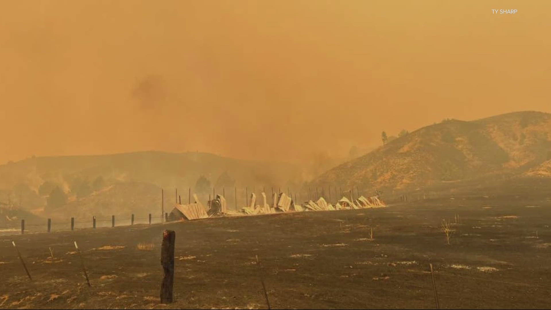
Oregon's wildfire season got off to a relatively slow start with just a few fires burning statewide as of early July, but conditions rapidly worsened during the middle of the month. A series of thunderstorms caused more than 2,000 lightning strikes across the state, according to the Oregon Department of Forestry, and high winds and dry conditions have helped fires spread.
As of July 28, Oregon counts at least 36 wildfires, with 1,059,187 acres reported burned across the state.
Gov. Tina Kotek issued an emergency declaration on July 12, which allows the Oregon fire agencies to get out-of-state support, and she has also issued emergency conflagration declarations for several fires, allowing for more resources to be mobilized.


The details of all major wildfires currently burning in Oregon are listed below, and the details will be continually updated. No fire that is more than 90% contained will be listed. Information about fire acreage and containment percentages is approximate.
The figures below are up to date as of July 28, 2024, unless otherwise noted.
- Location: Baker County, northwest of Ontario, about 30 miles from the Cow Valley Fire.
- Acreage: 288,690 acres
- Cause: Lightning
- Began: July 17
- Containment: 49%
- Closures: Drivers should prepare for off and on closures of I-84 in eastern Oregon as the fire is active. For the latest updates, check TripCheck.com.
- Evacuations: Level 3, Level 2 and Level 1 evacuations are in place in parts of Baker County around the fire. The Malheur County Fairgrounds wildfire shelter has been changed to the Four Rivers Cultural Center, 676 Southwest 5th Avenue in Ontario.
- More info: Visit the Facebook pages for the Malheur and Baker county sheriffs' offices or go to the Durkee Fire's entry on Inciweb.
Larch Creek Fire (daily updates have stopped)
- Location: Wasco County, about 60 miles south of The Dalles, just east of the Mt. Hood National Forest.
- Acreage: 18,286 acres as of July 19
- Cause: Believed to be human caused, still under investigation.
- Began: July 9
- Containment: 81% as of July 19
- Closures: None as of July 22.
- Evacuations: None as of July 22.
- More info: Visit the Larch Creek Fire information page on Facebook or go to the Larch Creek Fire's entry on Inciweb.
Falls Fire
- Location: Harney County, about 15 miles northwest of Burns, inside the Malheur National Forest.
- Acreage: 142,307 acres
- Cause: Believed to be human caused, still under investigation.
- Began: July 10
- Containment: 57%
- Closures: A significant portion of the southwest Malheur National Forest is closed, including about a dozen campgrounds.
- Evacuations: Evacuations are in place in Grant and Harney counties. Harney County has an interactive map of the evacuation zones.
- More info: Visit the Falls Fire information page on Facebook or go to the Falls Fire's entry on Inciweb.
Lone Rock Fire
- Location: Southeast corner of Gilliam County, extending into Morrow and Wheeler counties.
- Acreage: 137,214 acres
- Cause: Unknown, under investigation.
- Began: July 13
- Containment: 73%
- Closures: A portion of the northwestern Umatilla National Forest is closed.
- Evacuations: Level 2 evacuations are in place for residences south of Lone Rock in Gilliam County, as well as areas of Wheeler and Morrow counties.
- More info: Visit the Facebook pages of the Gilliam, Wheeler and Morrow county sheriffs' offices, the Central Oregon Fire Info website or the Lone Rock Fire's entry on Inciweb.
Pilot Rock/Juniper Canyon Fire (daily updates have stopped)
- Location: Umatilla County, near Pilot Rock
- Acreage: 19,000 acres as of July 18
- Cause: No information about the cause of the fire has been reported yet.
- Began: July 17
- Containment: No information has been reported about containment.
- Closures: None as of July 22.
- Evacuations: None as of July 22.
- More info: Visit the Umatilla County Sheriff's Office Facebook page.
Battle Mountain Complex (North Fork Owens Fire, Snake Fire, Monkey Creek Fire and Boneyard Fire)
- Location: Umatilla County near Ukiah, extending into Grant and Morrow counties.
- Acreage: 159,454 acres
- Cause: Lightning
- Began: July 17
- Containment: 7% (overall)
- Closures: None as of July 28.
- Evacuations: Level 3 evacuations are in place west of Highway 395 between Ukiah and Dale, and Level 1 evacuations are in place for the entire city of Ukiah. Level 2 evacuations are also in effect.
- More info: Visit the Umatilla County Sheriff's Office Facebook page or the Battle Mountain Complex's entry on Inciweb.
Boneyard Fire (merged into Battle Mountain Complex)
- Location: Grant County 10 miles north of Monument, extending into Morrow County.
- Acreage: 49,716 acres, as of July 25
- Cause: Lightning
- Began: July 17
- Containment: 3%, as of July 25
- Closures: Bureau of Land Management lands around the fire are closed to the public.
- Evacuations: Level 2 evacuations are in place. An evacuation center has been set up at Grant Union High.
- More info: Visit the Grant County Emergency Management Facebook page or the Battle Mountain Complex's entry on Inciweb.
Ore Fire
- Location: Lane County, about halfway between Eugene and Bend.
- Acreage: 1,400 acres
- Cause: Under investigation
- Began: July 16
- Containment: 20%
- Closures: The Willamette National Forest is closed around the fire.
- Evacuations: None as of July 28.
- More info: Visit the Ore Fire's entry on Inciweb.
Pyramid and Slate Fires
- Location: Linn County, in the Willamette National Forest.
- Acreage: 1,141 acres (overall)
- Cause: Lightning
- Began: July 17
- Containment: 8%
- Closures: The Willamette National Forest is closed around the fire.
- Evacuations: A Level 3 evacuation is in place inside the closure area. Linn County is maintaining an evacuation map.
- More info: Visit the Linn County Sheriff's Office Facebook page or the Pyramid Fire's entry on Inciweb.
Diamond Complex (26 fires)
- Location: Douglas County, in the Umpqua National Forest.
- Acreage: 4,990 acres (26 fires combined)
- Cause: Lightning
- Began: July 16
- Containment: 7% overall
- Closures: The Umpqua National Forest is closed around the fires.
- Evacuations: Level 3, Level 2 and Level 1 evacuations are in place for some of the fires in the Diamond Complex. Linn County is maintaining an evacuation map.
- More info: Visit the Douglas County Sheriff's Office Facebook page or the Diamond Complex's entry on Inciweb.
Homestead Complex (7 fires)
- Location: Douglas County, in the Umpqua National Forest.
- Acreage: 1,466 acres (7 fires combined)
- Cause: Lightning
- Began: July 16
- Containment: 4% (level varies from fire to fire)
- Closures: The Umpqua National Forest has issued two closures across the forest.
- Evacuations: None as of July 24
- More info: Visit the Douglas County Sheriff's Office Facebook page or the Homestead Complex's entry on Inciweb.
Lane 1 Fire
- Location: Lane County, 15 miles southeast of Springfield
- Acreage: 1,617
- Cause: Lightning
- Began: July 17
- Containment: 0%
- Closures: The Umpqua National Forest has issued closures, along with the Bureau of Land Management. Several county roads are closed except to owners of private lands accessed from the roads.
- Evacuations: None as of July 28.
- More info: Visit the Lane 1 Fire's entry on Inciweb.
Red Fire
- Location: Klamath County, 20 miles southwest of La Pine
- Acreage: 416 acres
- Cause: Lightning
- Began: July 17
- Containment: 0%
- Closures: A closure is in effect for the entire Diamond Peak Wilderness.
- Evacuations: Level 1 evacuations for Crescent Lake, Odell Lake, Crescent Junction.
- More info: Visit the Red Fire's entry on Inciweb.
Microwave Tower Fire (initially called Mosier Fire)
- Location: Wasco County, south of Mosier
- Acreage: 1,062 acres
- Cause: Unknown
- Began: July 22
- Containment: 53%
- Closures: None as of July 28.
- Evacuations: Level 3 , Level 2 and Level 1 evacuations remain in place near the town of Mosier.
- More info: A Red Cross center is open at Hood River Middle School. The Mosier Senior Center at 500 East 2nd Avenue is being used as a cooling center and place where residents can also charge their devices. Visit the Microwave Tower Fire Facebook page or the Wasco County Sheriff's Office Facebook page, as well as the fire's entry on Inciweb.
Telephone Fire
- Location: Harney County, about 15 miles north of Burns
- Acreage: 22,429 acres
- Cause: Lightning
- Began: July 22
- Containment: 0%
- Closures: None
- Evacuations: Level 3, Level 2 and Level 1 evacuations are in place. Harney County is maintaining a map of evacuation zones here.
- More info: Visit the Harney County Sheriff's Office Facebook page or the Harney County Emergency Management Facebook page, or the Telephone Fire's entry on Inciweb.