

PORTLAND, Ore. — Editor's note: For the latest story on wildfires in Oregon, click here.
Wildfire conditions in Oregon have rapidly worsened with more than 1 million acres burned across the state, making Oregon by far the worst off out of all the states in terms of acres burned this summer. The Durkee Fire in eastern Oregon was also the largest wildfire in the country until the Park Fire in California surpassed it.
Gov. Tina Kotek issued an emergency declaration on July 12, which allows the Oregon fire agencies to get out-of-state support. She also issued emergency conflagration declarations for several fires, allowing for more resources to be mobilized.
As of August 5, Oregon counts at least 25 major wildfires, with an estimated 1,004,662 acres actively burning across Oregon, according to the National Interagency Fire Center.
The details of all major wildfires currently burning in Oregon are listed below, and the details will be continually updated. No fire that is more than 90% contained will be listed. Information about fire acreage and containment percentages is approximate.
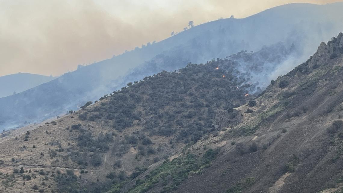
The figures below are up to date as of Aug. 11, 2024, unless otherwise noted.

- Location: Baker County
- Acreage: 18,552 acres
- Cause: Unknown
- Began: August 4
- Containment: 37%
- Closures: Unknown
- Evacuations: Level 3 (Go Now) and Level (Be Set) are in place for several areas in Baker County.
- More info: Visit the Facebook page for Baker County Sheriff's Office.
- Location: Madras in Jefferson County
- Acreage: 5,176 acres
- Cause: Lightning
- Began: August 4
- Containment: 65%
- Closures: Fire planes have been dipping in and out of Lake Simtustus; Jefferson County Sheriff's Office has asked that people avoid the area.
- Evacuations: All evacuations levels have dropped to below Level 3 (Go Now).
- More info: Visit the Facebook page for Jefferson County Sheriff's Office or Central Oregon Fire Info's website. Residents can also sign up for alerts here.
Homestead Complex (7 fires)
- Location: Douglas County, in the Umpqua National Forest.
- Acreage: 3,841 acres (7 fires combined)
- Cause: Lightning
- Began: July 16
- Containment: 14% (level varies from fire to fire)
- Closures: The Umpqua National Forest has issued two closures across the forest.
- Evacuations: None as of July 24
- More info: Visit the Douglas County Sheriff's Office Facebook page or the Homestead Complex's entry on Inciweb.
Oakridge Lightning Fires (7 fires)
- Location: Lane County, about halfway between Eugene and Bend (near Homestead Complex and Ore Fire)
- Acreage: 12,193 acres (7 fires combined)
- Cause: Under investigation
- Began: Lightning
- Containment: 38%
- Closures: The Willamette National Forest is closed around the fire.
- Evacuations: A couple Level 1 (BE READY) evacuations in parts of Lane County around the fire.
- More info: Visit the Oakridge Lightning Fire's entry on Inciweb.
Ore Fire
- Location: Lane County, about halfway between Eugene and Bend.
- Acreage: 2,507 acres
- Cause: Under investigation
- Began: July 16
- Containment: 21%
- Closures: The Willamette National Forest is closed around the fire. Check here for further details.
- Evacuations: None as of July 28.
- More info: Visit the Ore Fire's entry on Inciweb.
Falls Fire
- Location: Harney County, about 15 miles northwest of Burns, inside the Malheur National Forest (near Telephone Fire).
- Acreage: 148,519 acres
- Cause: Believed to be human caused, still under investigation.
- Began: July 10
- Containment: 77%
- Closures: A significant portion of the southwest Malheur National Forest is closed, including about a dozen campgrounds.
- Evacuations: Evacuations are in place in Grant and Harney counties. Harney County has an interactive map of the evacuation zones.
- More info: Visit the Falls Fire information page on Facebook or go to the Falls Fire's entry on Inciweb.
Telephone Fire
- Location: Harney County, about 15 miles north of Burns (near Falls Fire).
- Acreage: 53,852 acres
- Cause: Lightning
- Began: July 22
- Containment: 61%
- Closures: None
- Evacuations: Evacuation levels have lowered for several areas, check the Harney County Sheriff's Office Facebook page for current evacuation zones here.
- More info: Visit the Harney County Sheriff's Office Facebook page or the Harney County Emergency Management Facebook page, or the Telephone Fire's entry on Inciweb.
Crazy Creek Fire
- Location: Wheeler and Crook County, about 16 miles north of Paulina.
- Acreage: 81,085 acres
- Cause: Lightning
- Began: July 22
- Containment: 60% (Crazy Creek)
- Closures: None
- Evacuations: Mandatory evacuation orders remain in effect for areas in Crook and Wheeler counties. Level 3 evacuations have extended from the Forest Boundary to Highway 380. Level 2 evacuations have extended south of Highway 380. The town of Paulina is also under Level 3 evacuation status.
- More info: Visit the Central Oregon Wildfire Information for more info.
Pyramid Fire
- Location: Linn County, in the Willamette National Forest.
- Acreage: 1,323 acres
- Cause: Lightning
- Began: July 17
- Containment: 47.5%
- Closures: The Willamette National Forest is closed around the fire.
- Evacuations: A Level 3 evacuation is in place inside the closure area. Linn County is maintaining an evacuation map.
- More info: Visit the Linn County Sheriff's Office Facebook page or the Pyramid Fire's entry on Inciweb.
Here's what evacuation levels mean
Level 1 Notice - Be Ready: Residents should be aware of the danger that exists in their area and monitor local media outlets for information. Residents with special needs should take note and begin making arrangements to evacuate. Evacuations at this time are voluntary.
Level 2 Notice - Be Set: This level indicates there is significant danger to your area, and residents should either voluntarily relocate to a shelter or outside of the affected area, or if choosing to remain, to be ready at a moment's notice. Emergency services cannot guarantee that they will be able to notify you if conditions rapidly deteriorate.
Level 3 Notice - Go Now: Danger to your area is current or imminent, and you should leave immediately. Listen to local media and watch for emergency personnel who may be coming by to give further instructions regarding the evacuation.