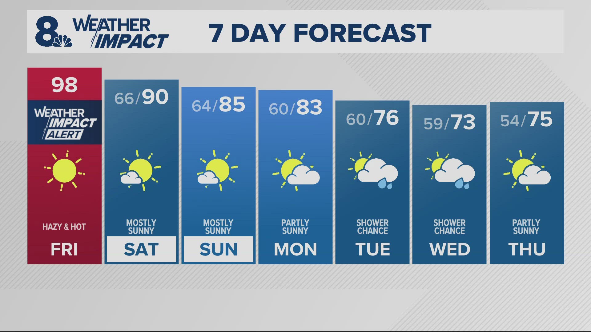

PORTLAND, Ore. — Thursday’s weak cold front is the first push of colder air returning to the Northwest, which will pave the way for the first frost of the season in some spots. Travelers should look out for pass-level snow showers, but don't expect anything to stick.
And we're not even a week in to the fall season.
The real cool-off begins Friday, with increasing showers likely, followed by the coldest overnight lows and daytime highs of the early fall season.
RELATED: Check the latest forecast
Assuming showers mostly end for the valley Sunday morning, Portland will dip below 50 degrees for the first time this fall season.
The air will likely be dry and cool enough to produce widespread temperatures in the 30s Monday morning, including the possibility of frost in spotty locations, such as Hillsboro, Battle Ground and other usual morning cold spots.
Monday and Tuesday will bring the first realistic chance of freezing temps to the valley, although Portland will likely hold near 40 degrees.
It all means that those sensitive plants you're not ready to lose should be protected.
Starting late Friday night and lasting through Sunday, travelers should stay alert for the first snow showers of the season at pass level. Ground temps at pass level will likely hold above freezing during the day, meaning no significant icing is expected.
If the skies part, we may all be treated to a visual fresh skirt of snow in the high country Sunday morning.
More helpful links:
- Interactive Radar kgw.com/radar
- Traffic speeds kgw.com/traffic
- Traffic alerts kgw.com/traffic-alerts
- Hourly forecast and hyperlocal radars kgw.com/weather
- Weather alerts kgw.com/severe-weather
- 10-day outlook kgw.com/10-day
- Weather cameras kgw.com/live-cameras
- Traffic cameras kgw.com/traffic-cameras
And LIVE weather cameras: