
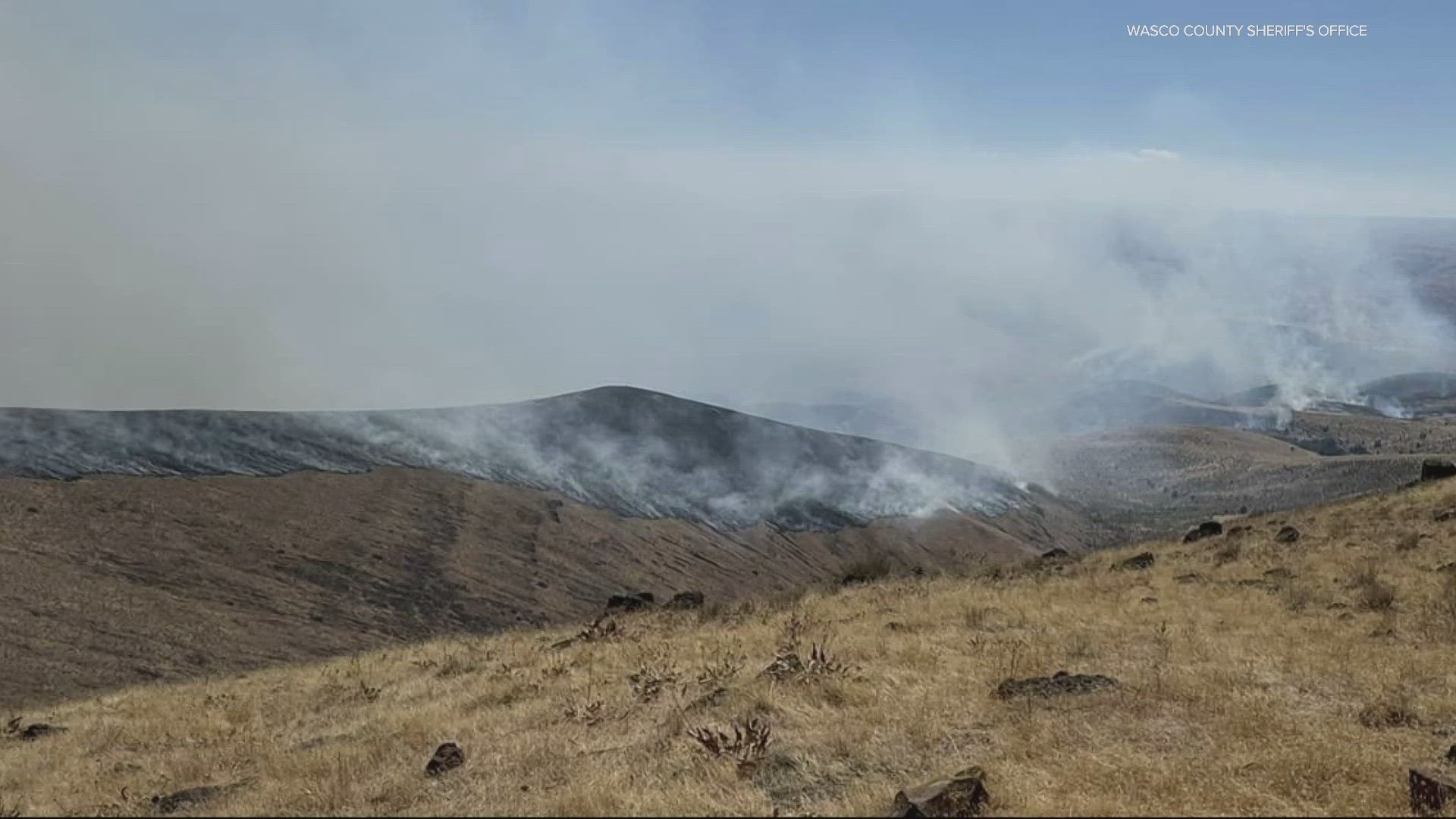
TYGH VALLEY, Ore. — The Oak Canyon Fire, burning east of Tygh Valley in Wasco County, has prompted Level 3 (Go Now) evacuation orders, the Wasco County Sheriff's Office reported. The fire has burned more than 15,170 acres, which is over 23 square miles or roughly the size of Gresham, and two outbuildings have been damaged.
It is 25% contained, as of Wednesday evening. More fire engines and a hot shot crew have been ordered, according to Central Oregon Fire.
The fire started Sunday night during a thunderstorm in Tygh Valley. There are Level 3 (Go Now), Level 2 (Be Set) and Level 1 (Be Ready) evacuation orders for residents in the area. A temporary evacuation location has been set up at the Wasco County Fairgrounds. The fairgrounds are open for livestock and horses.
Here's a look at the latest evacuation orders, as of 7:30 p.m. Tuesday:
North Side
- Level 1 (Be Ready): from the Tygh Ridge/Highway 197 intersection east to 60833 Tygh Ridge Road to include Hulse Rd; Highway 216
- Level 2 (Be Set): from north side of Highway 216 from milepost 1 to milepost 3.
- Level 3 (Go Now): for all of Conroy Road up to one mile east and west of Conroy Road, north of Highway 216.
South Side
- Level 2 (Be Set): from Canyon Road/Highway 216 east to the Deschutes River and south to Oak Springs Road to Deschutes River.
The Bureau of Land Management (BLM) has also closed a portion of the Deschutes River and its surround lands to public access due to the fire:
- All BLM-administered lands on the east side of the Deschutes River, from the intersection of the Lower Deschutes Access Road and State Highway 216 downstream to Macks Canyon. This includes closure of the Lower Deschutes Access Road.
- All BLM-administered lands on the west side of the Deschutes River, from the Oak Springs Fish Hatchery downstream to Craft Canyon, across from Macks Canyon.
- All boating in Segment 3 of the Deschutes River is closed.
- Boating is allowed in Segment 4 of the Deschutes River, but no launching is allowed from Mack's Canyon boat ramp.
Here's what evacuation levels mean
Level 1 Notice - Be Ready: Residents should be aware of the danger that exists in their area and monitor local media outlets for information. Residents with special needs should take note and begin making arrangements to evacuate. Evacuations at this time are voluntary.
Level 2 Notice - Be Set: This level indicates there is significant danger to your area, and residents should either voluntarily relocate to a shelter or outside of the affected area, or if choosing to remain, to be ready at a moment's notice. Emergency services cannot guarantee that they will be able to notify you if conditions rapidly deteriorate.
Level 3 Notice - Go Now: Danger to your area is current or imminent, and you should leave immediately. Listen to local media and watch for emergency personnel who may be coming by to give further instructions regarding the evacuation.