PORTLAND, Ore. — What will winter be like? Or, to get down to the number one question we get about the upcoming winter season, WILL IT SNOW IN PORTLAND and the rest of western Oregon?
I’ll get to that. But let me give you the lay of the climatescape first. I just made up that word. It’ll probably never stick. Unlike valley snow this winter.
Yes, that was a tease for the rest of this article.
The biggest driver for our winter weather, that we know of and can quantify, is whether we have an El Niño, a La Niña, or neither. We have a La Niña right now. I’ll say a little about the opposite of La Niña, El Niño, which usually brings warmer and drier winter weather to the Northwest. Since that’s NOT what we’re expecting, let me explain La Niña.
A La Niña means the equatorial waters for the Pacific Ocean are cooler than average in the eastern and central Pacific, and warmer than average in the western Pacific. like around Indonesia.
Why do we care about ocean temperatures thousands of miles away from North America? Because it helps drive and control the jet stream pattern around the hemisphere. And THAT determines, to a large degree, what kind of winter we will have.
La Niñas are interesting because they’re so different from the average, or "No Niño" pattern. Even an El Niño has more in common with the average pattern than a La Niña, in that an El Niño is a little like the normal pattern, but with more amplitude, that is to say, a normal pattern on steroids.
And we often end up with long periods of stable (boring) weather in an El Niño. This winter, I expect, will not be that.
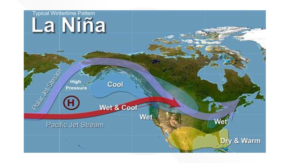
During a La Niña, the jet stream pattern often undergoes wild mood swings. Look at the graphic below:


Keep in mind the positions of the jet streams portrayed here are averages. This can and will change over the course of winter. During past La Niña’s we’ve seen dramatic changes in jet stream locations and intensity. What that means is that we can see, for example, a cold dry pattern turn warm and wet, and then back again, in a matter of days.
You may be thinking: OK thanks for the climatological gobbledygook. Is it going to snow, or not?
Here’s what I expect to see this winter:
Valley snow
Most likely we will get at least one or two significant valley snowfalls. Hard to pinpoint when and how much, but La Niñas have delivered some epic valley snows. Like January 2017 when downtown Portland was buried under a foot of snow and the temperature didn’t climb out of the 20s for four straight days.
Snow was on the ground for a week.
RELATED: January 2017 snowstorm in Portland
I hesitate to use what we call analog years as a forecast tool to nail down specifics, because every year is different. An analog year is a year, or years, that have similar set ups in La Niña, El Niño, or other hemispherical weather patterns. In one respect I’m doing that here by simply classifying this as a La Niña year. But drilling down to more specific time frames within the winter season hasn’t shown much forecast skill.
Mountain snowfall
It's often EPIC in the Northwest in La Niña winters! Both in terms of quantity and quality (coldness) of snow. The juxtaposition of the two jet streams in the graphic above shows why.
We often get a moist Pacific jet delivering the moisture, but the polar jet, which delivers cold air and keeps the snow level low, is usually in play too. There are a couple caveats. During some La Niña years, we see a big gradient of snowpack across the Cascades. The Washington Cascades and Mt Hood fare extremely well, Mt. Bachelor about average. But southern Oregon and California can end up quite dry, which would be especially unfortunate this year given wildfire season.
But remember, each La Niña year is a little different from the next, so we’ll have to wait and see.
Windstorms
La Niña years can usually be relied on to deliver at least a couple strong winds storms to the Northwest. Again, we look at the active jet streams, which can work to spin up strong storms.
Other
We already saw a historic east wind event (Labor Day) and it wasn’t even fall yet. That was an interesting pattern, meteorologically. If this moderate La Niña develops into a strong one, we may end up cold and dry with a lot of east wind. Right now that’s not expected to happen, but we’ll see how La Niña evolves over the next couple of months.
Also in the “other” category are ice storms. The set up for that is usually the transition into, or especially out of, an east wind pattern. So ice is definitely on the table during a La Niña.
Bottom Line
The key word is variety. I expect an active, stormy winter, with the potential for lots of different kinds of storms. It’s still 2020, the year of the weird. I don’t think we should expect it to end, or 2021 to begin, any differently than that.
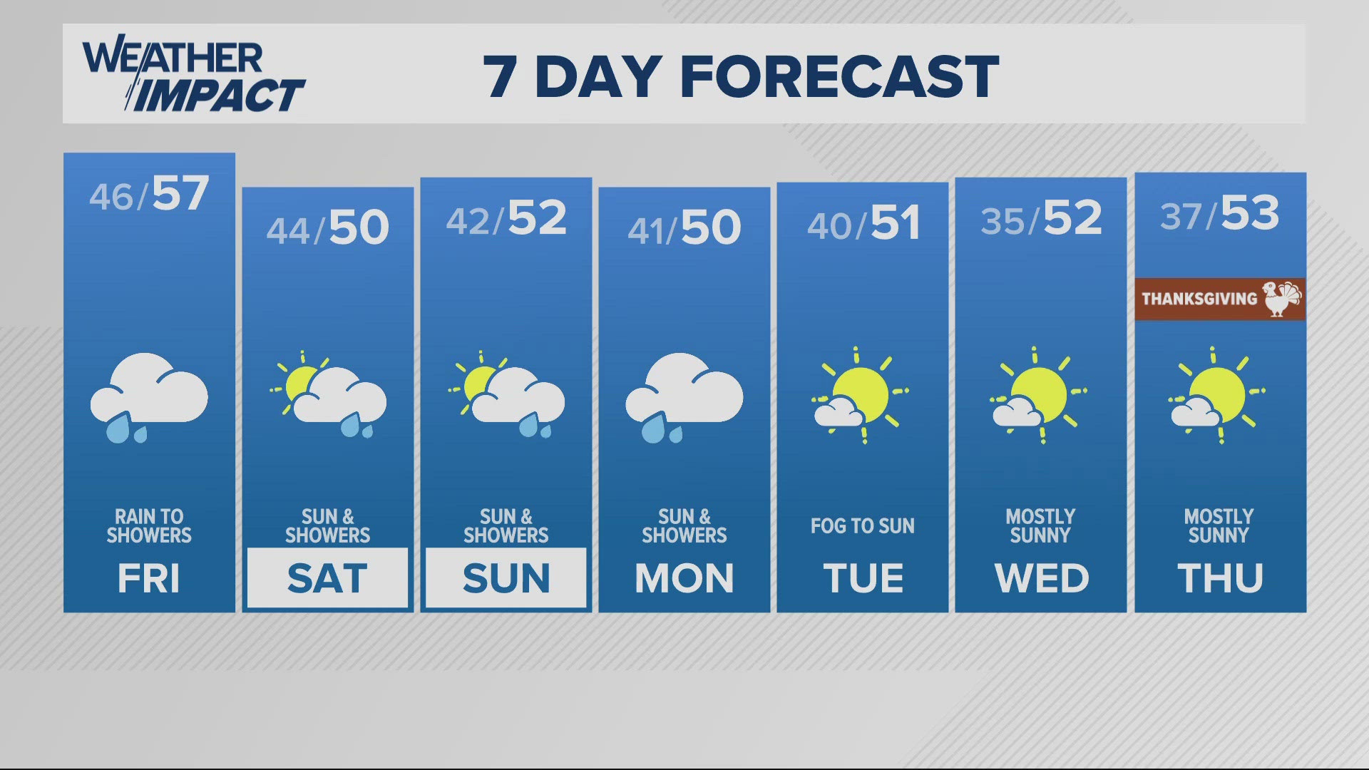
Check out the latest (short-term) forecast: Another week of dry weather
Want more Zaffino? Check out Matt's podcast, Under the Big Umbrella, where he explores some of the quirky, interesting, mostly weather-related topics that will leave you feeling wowed and maybe a bit smarter. Matt keeps each episode to no longer than 7 minutes, just enough time to listen while you get where you’re going.
SUBSCRIBE/LISTEN: Apple Podcasts | Spotify | Stitcher


