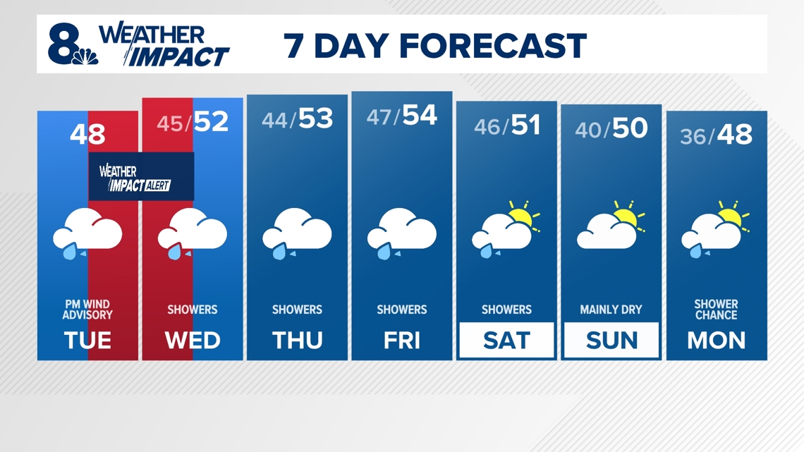
PORTLAND, Ore. — Winds began to pick up speed across western Oregon late Tuesday afternoon as the edge of a bomb cyclone storm started to clip the region, kicking off a high wind event that's expected to continue through the night up and down the coast and Willamette Valley. KGW has issued a Weather Impact Alert for the Portland area from 4 p.m. Tuesday to 4 p.m. Wednesday.
Winds remained relatively calm in downtown Portland and the central valley as of around 4:30 p.m., according to KGW chief meteorologist Matt Zaffino, but places further east and west began seeing stronger peak gusts: nearly 40 mph at Portland International Airport, nearly 50 mph at Crown Point and above 40 mph at points along the coast.
Winds are expected to pick up around Portland as the evening goes on, with parts of the metro area seeing gusts up to 40 mph by around 8 p.m., Zaffino said, along with 40 mph gusts along nearly all of the coast and in the Columbia River Gorge and Cascades, though things will remain calmer in the central valley around Salem.
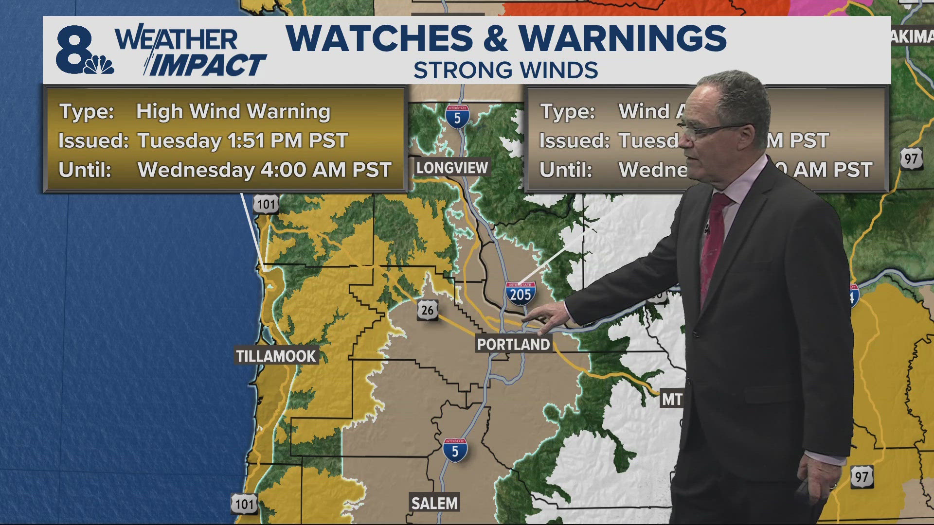
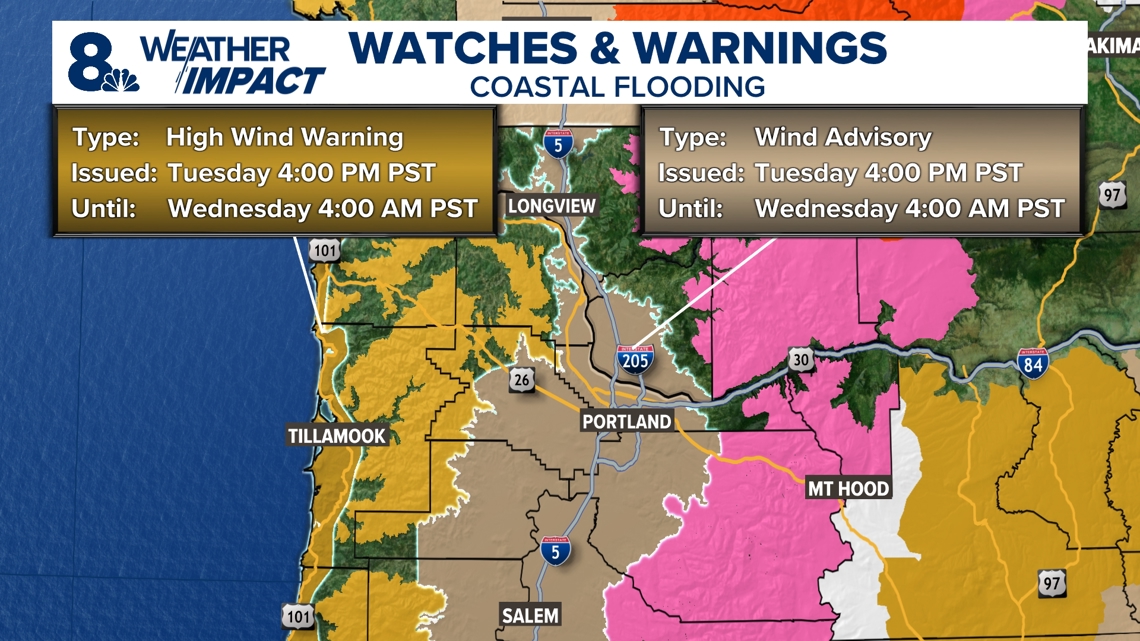
The storm shouldn't bring widespread damaging winds in Oregon, but the potential for gusts up to 60 mph at the coast prompted the National Weather Service (NWS) to issue a High Wind Warning until 4 a.m. Wednesday. The wind in the Portland area won't be as strong, because the storm is staying far enough away to limit the impact.
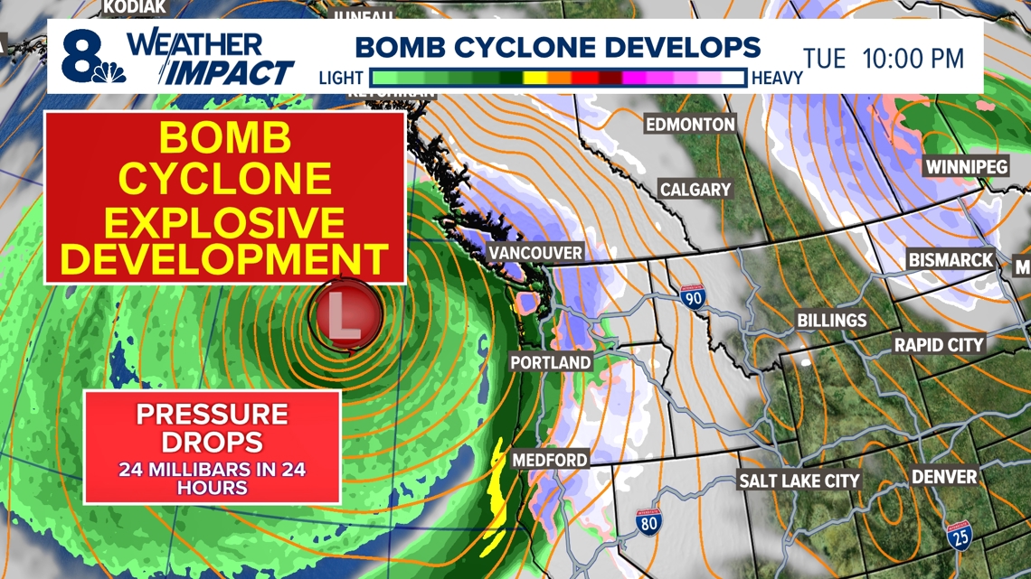
"The bomb cyclone is real; there's a big low, but the impact is only there if it comes to see you. And the models keep insisting this low is largely going to stay out to sea," KGW meteorologist Rod Hill explained Tuesday afternoon. "We'll get some impact from it, but perhaps minimal."

The coast is expected to see 2 to 3 inches of rain Tuesday, bringing flooding concerns for high water spots. The valley will see less rain, limiting flooding concerns for the remainder of the week.
PGE's and Pacific Power's outage maps show that there's over 4,000 customers affected by outages in the Grants Pass area, with a little more than 100 customers affected in the Brentwood-Darlington and Lake Oswego neighborhoods.
In Portland
The peak wind period in Portland is likely to be about 6 p.m. Tuesday to midnight, Zaffino said, with the winds steadily slowing down through the early morning hours in Portland, down to gusts of only 10 mph by around 8 a.m. Wednesday.
Getting into the later morning, it'll be the middle and lower valley's turn for somewhat higher wind, with gusts up to 25-30 mph in Corvallis and Salem.
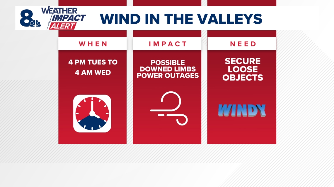
The valleys are under a Wind Advisory until 4 a.m. Wednesday, and KGW has issued a Weather Impact Alert from Tuesday afternoon into early Wednesday morning. Valley gusts are still expected to reach about 40 mph Tuesday night, so there is still a chance of downed tree limbs or power outages in isolated areas, as well as things like garbage cans being blown around.

At the Oregon coast
The NWS has issued a High Wind Warning for the entire Oregon Coast and coastal portions of Pacific County in Southwest Washington for the same time period, 4 p.m. Tuesday through 4 a.m. Wednesday. South winds will blow at 25-35 mph and are expected to reach sustained speeds of 40 mph in beaches and headland areas, with gusts of 60 mph expected.
Damaging winds are likely to bring down trees and power lines, the NWS said, and urged people to avoid being outside in forested areas or near trees, and to try to stay in the lower levels of their homes and away from windows during the windstorm. Vehicle travel will be difficult, the agency said.
The National Weather Service Medford office has also issued a Hurricane Force Wind Warning for offshore areas along the southern Oregon Coast south of Florence from 10 a.m. Tuesday to 7 a.m. Wednesday, with winds of 50-60 knots and gusts hitting up to 70 knots, which is about 80 mph.
"Extremely strong winds and very steep and mountainous seas will likely capsize or damage vessels," the agency wrote, urging mariners to keep their vessels in port. "Near zero visibility expected. Bars will become impassable."

In the Cascades
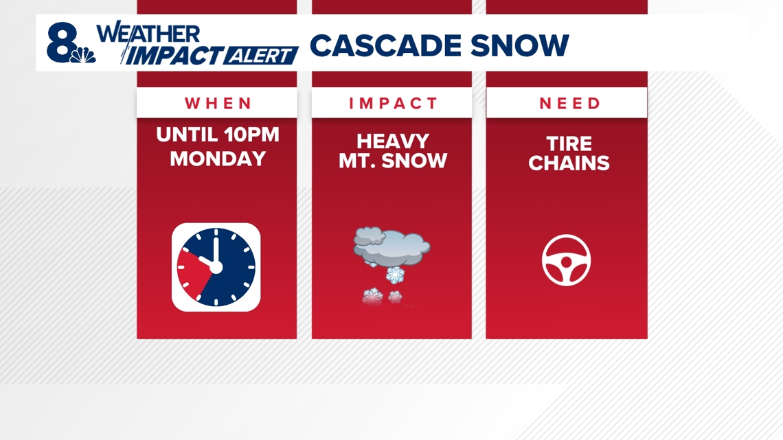
A Winter Storm Warning was in effect through 10 p.m. Monday in the Cascades and Cascade Foothills, with the NWS warning of heavy snowfall in areas above 2,000 feet. Snow was also likely at areas above 1,500 feet, and more than two feet of snow was expected to fall at the various Mt. Hood ski resorts, and more than 8 inches at pass level.
"On paper this looks to be the wildest stretch of weather in terms of consecutive days we've had," Hill said. "It's certainly the biggest snowstorm at pass level up in the Cascades happening right now that we have had so far this fall."
That storm ended on Monday, but heavy snow is expected to continue overnight Tuesday in the Cascades due to the bomb cyclone, Zaffino said.
Traction tires or chains will likely be necessary for drivers heading through Mount Hood Pass, with Oregon Department of Transportation cameras showing snow on the roads all along the route. The NWS warned of slippery road conditions and suggested postponing travel if possible.

What are Weather Impact Alert days?
It’s our goal to make sure you have the most accurate and up-to-date information about the weather and its impact on you. The new KGW Weather Impact Alerts will be just that, alerts as far in advance as possible, so that you can be armed with accurate information to keep yourself and your family safe.

