PORTLAND, Ore. — Much of the Pacific Northwest is under various watches and warnings this weekend, as an arctic blast is expected to bring accumulations of snow and sleet, and dangerously cold temperatures to the Portland-Vancouver metro area this weekend.
Exactly how much snow could fall this weekend is still in question, but KGW meteorologist Rod Hill said the heaviest accumulations will be on Saturday, and there could be anywhere from several inches, up to eight inches of snow.
Here's a look at the latest weather forecast and what to expect in the Portland-Vancouver metro area.
Friday
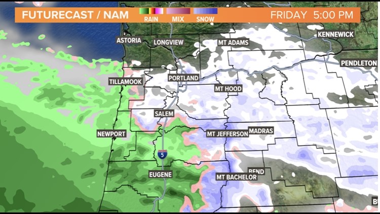
Cold arctic air traveling across the Columbia River on Friday is expected to bring light snow showers or flurries during the day. Dustings of snow is possible, but not guaranteed, Hill said.
The morning begins with temperatures around 40 degrees, but the arrival of cold arctic air will steadily bring those temperatures to freezing levels by the afternoon, Hill said.
"Temperatures are going to be dropping during the morning hours. Could be freezing here by the noon hour after starting off around 38 to 40 degrees," Hill said.
The National Weather Service (NWS) has issued a Winter Storm Watch for western Oregon and southwest Washington that will go into effect at noon on Friday.
"For today, it’s light snow, flurries, cold air, east winds picking up. The main storm event in terms of (precipitation) is tomorrow," Hill said.
'PLEASE AVOID TRAVEL': PBOT urges safety ahead of weekend winter storm
Saturday
Precipitation will begin Saturday morning and will continue for much of the day, according to Hill. A mix of snow and sleet is expected to fall, but how much will accumulate is difficult to pinpoint.
"Depending on where you are, from a few inches to as much as, 'Wow, we've got eight inches we've got to shovel," Hill said.
The image below, taken from radar, shows snow (pink), and a mix of rain and snow (purple), across the region around 10 a.m.

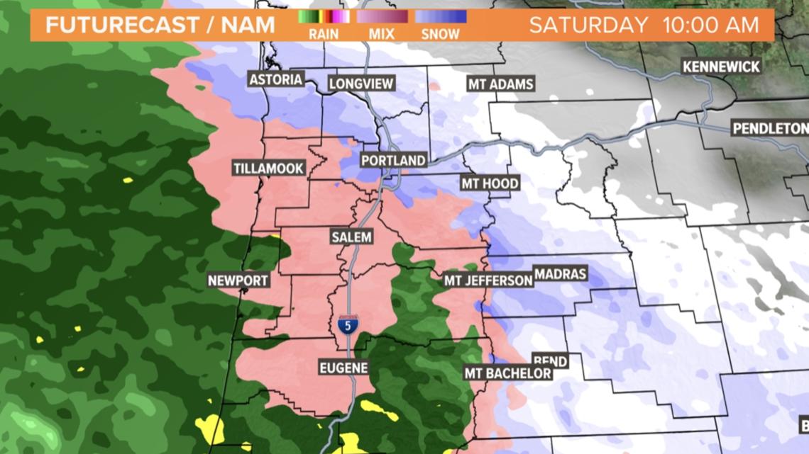
There will also be windy conditions, with east gusts expected to reach 20 to 40 mph, but the east side could see as much as 50 mph, Hill said. That will produce wind chills between zero to 10 degrees for much of the day.
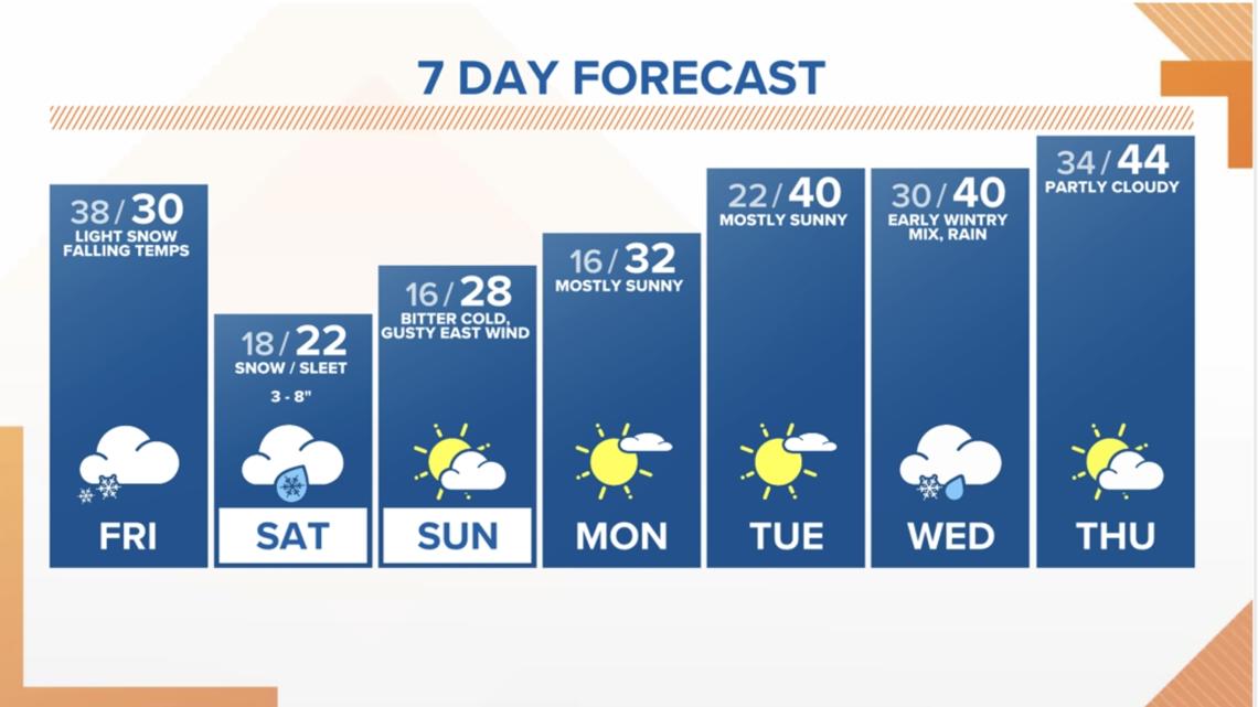
The winter storm is set to end Saturday overnight for the Portland-Vancouver metro area. Sunday will be dry, with cold temperatures, gusty winds and icy roads, Hill said.
The 7-day forecast below shows that temperatures are expected to remain cold during the first part of next week.

Other parts of the Willamette Valley, the Gorge and the Oregon coast
The Salem area could see light snow or flurries on Friday, while rain showers are expected in Eugene.
In the Cascades and into the Blue Mountains in northeastern Oregon, heavy snow amounts are expected on Friday. Wind chills in the Cascades as well as the Gorge may reach 25 below zero, Hill said.
On Saturday, there may be heavy ice accumulations in the south to mid-Willamette valley, from Salem to Eugene and near Wilsonville. Ice accumulations may reach 1.25 inches in some areas, Hill said. Temperatures throughout the Willamette Valley will hold near 20 degrees.
Heavy icing may also show up over parts of the Oregon coast, according to Hill.