PORTLAND, Ore. — As the Portland metro area continues to deal with the thawing of snow and ice, Columbia River Gorge and the upper Hood River Valley are bracing for freezing rain.
KGW meteorologist Joe Raineri says after seeing, snow and ice this past week, we're going to see conditions improve over the next several days. Thanks to a more southerly flow, the metro area might be seeing warmer weather starting Monday with highs around the low 50s — with scattered showers a good part of this week.
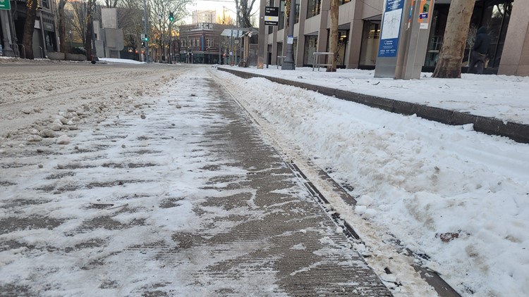
The metro area might be seeing warmer weather, but there's still going to be areas of freezing rain in the Gorge overnight Sunday and into early Monday morning. Allowing for ice and snow to begin melting, but pedestrians and drivers still need to remain cautious; the Multnomah County Health Department reported a new daily high — 222 — of "slip-and-fall" visits on Friday. There have been 1,035 fall visits since Jan. 12, the department said Saturday.
This week in the Portland metro area will look rainy and warmer, with highs in the 50s beginning Tuesday.
A flood watch has been issued for portions of southwest Oregon this weekend, which will last through Monday morning, bringing with it a greater threat for landslides. Curry County, near the coast, is expecting two to five inches of rain over the weekend.
"Debris flows are the ones that we are really concerned about for life safety because they can move really fast. They can move tens of miles per hour. So, if you are traveling through areas like under burn scars or along roads that go through burn scars, you want to be extra careful," warned Bill Burns, a geologist.
Freezing rain is likely in the Gorge and Hood River Valley overnight, Sunday and into early Monday morning.
Lake Oswego reported a few slick areas, but overall, main roads are in "good shape." However, the city cautioned that higher elevation areas and residential/side streets will still continue to be the most impacted as ice melts.
Public transportation
Service for Amtrak Cascades trains between Portland and Seattle will be modified until Tuesday due to a track closure south of Kelso, according to Amtrak.
The company cited previous weather events as the reasoning behind the track closure which is expected to remain until Jan. 23 at 10:45 a.m., when tracks are expected to reopen.
Amtrak Cascades trains between Portland and Seattle have been canceled over the weekend due to the landslide, according to the Washington State Department of Transportation.
RELATED: Amtrak trains between Seattle and Portland temporarily suspended until Tuesday due to track closure
TriMet said as of Sunday, all MAX lines have been fully restored. Trains are running on the MAX Green Line between Gateway Transit Center and Clackamas Town Center.
The MAX Blue Line was briefly disrupted due to an object blocking the tracks near Old Town and Chinatown, with shuttle buses serving between Oak and Southwest 1st and Cleveland avenues.
TriMet announced a full reopening of the MAX Yellow Line Saturday morning. In addition to the Yellow Line returning to full service, the transit agency also announced that portions of the Orange and Blue lines have reopened.
Power outages
PGE estimates that there are 570 customers are without power, with 66 reported outages, as of 11:40 p.m. Sunday. That's down from Friday evening, where there were 14,073 customers without power.
PGE said in a Saturday press release that it has restored service to around 300,000 customers. Crews are still working on areas where trees, tree limbs and debris downed power lines and poles, particularly in the Southwest Portland and Beaverton neighborhoods.
Pacific Power reported no outages as of Sunday evening.
Clark Public Utilities said it has no current outages, as of 11:43 p.m. Sunday.
Closures and openings
Northeast 238th Drive is open Saturday evening, after closing earlier this week due to icy conditions, according to Multnomah County.
Part of East Knieriem Road in Corbett is closed due to a downed tree having damaged part of the street and is currently blocking the road, according to Multnomah County.
Southeast Littlepage Road at Northeast Houston Road is also closed, with a tree and power lines blocking the road, Multnomah County warned Saturday afternoon. The county's Road Maintenance team estimates 40 to 50 trees have blocked at least a portion of roads.
Multnomah County libraries, clinics and Animal Services were closed Saturday.
Tualatin Hills Parks and Recreation said all buildings will be closed Monday to "focus on essential storm recovery work" until further notice. Portland Parks and Recreation is also closed Monday.
State offices will be closed Monday in both Sherman County and Gilliam County. This does not apply to courts or legislative offices.
Portland Community Colleges will be open Monday, Mount Hood Community College campuses and events will remain closed.
Multnomah Falls Lodge is currently closed until further notice due to flooding.
Columbia River Highway will likely remain closed through the weekend due to debris and ice, according to the Oregon Department of Transportation (ODOT).
Several roads in east and west Multnomah County were closed Friday morning due to icy conditions, downed trees and power lines.