
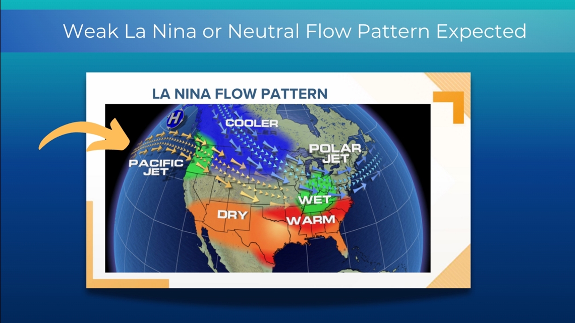
PORTLAND, Ore. — This year's winter outlook is based on a so-called cool-neutral cycle, or a weak La Niña. A La Niña is based on cooler than normal water temperatures near the equator off the coast of South America. A neutral cycle means water temperatures are near normal.
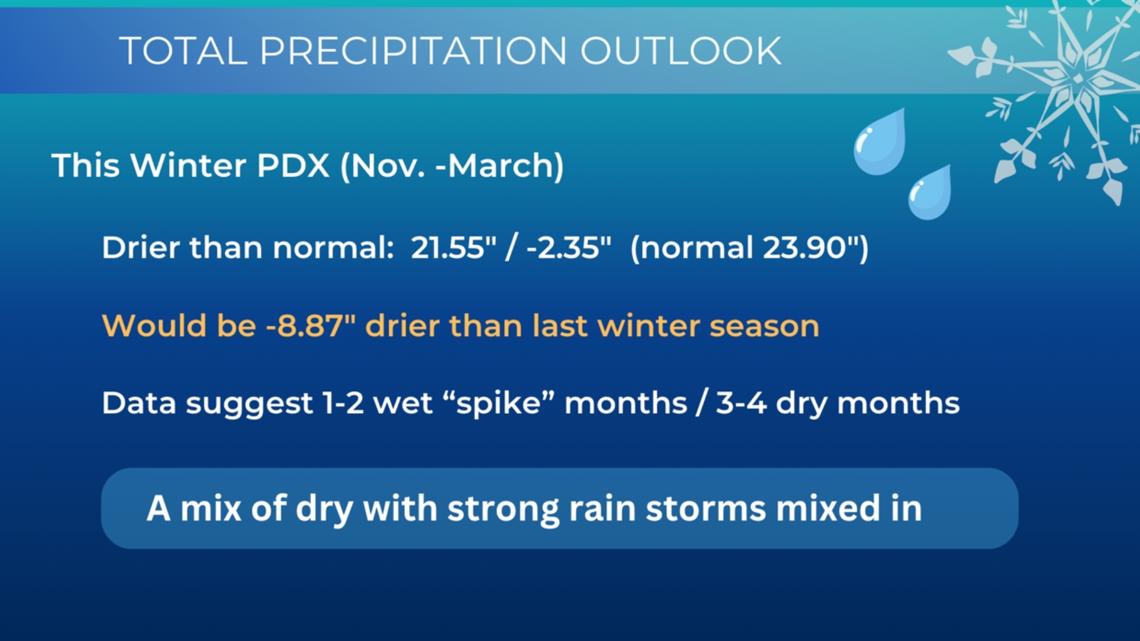
While the National Oceanic and Atmospheric Administration has been projecting a La Niña winter, at the time of this forecast, La Niña has still not arrived, though it may do so during the month of November. The forecast I am giving is based on Portland's rainy season: the months of November through March. The period averages 23.90 inches of total precipitation and four inches of valley snowfall. The snowfall total average is low due to the sporadic nature of years with big snowstorms and years with only a trace of snow.
La Niña winters in the Northwest often see active storm flows because the jet stream entry quadrant into the lower 48 states is over the Pacific Northwest, driving storm fronts inland.

Less precipitation this year
My first headline is tied to a weak La Niña average of total precipitation. If Portland receives less than 20 inches of precipitation this rainy season, the total amount would be some 10 inches less than last winter and definitely noticeable.


Near-average temperatures
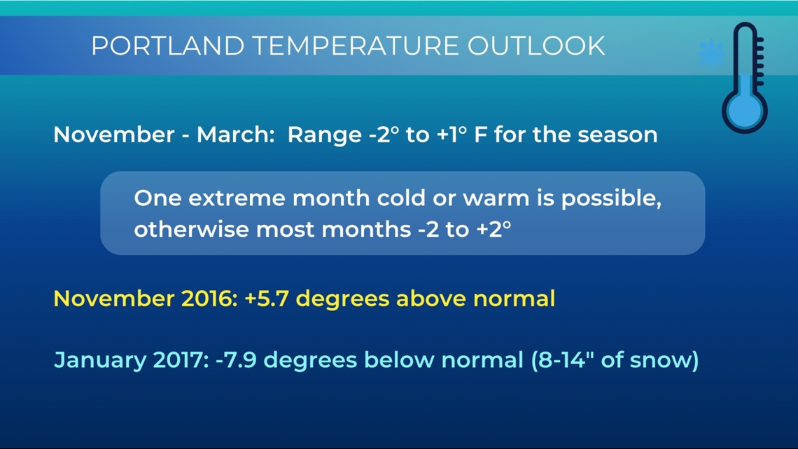
I don't find a strong signal to project temperature patterns this winter, other than to say, most of the upcoming five months will average up to 1 degree above normal to colder than seasonal climate by 1-2 degrees.

Chance of big snowstorms in Portland
Valley snowfall is always a challenging call. The seven years I am using for a roadmap shows a 60% chance of seeing one to two big snow events. I do feel confident in saying any winter storms this winter will produce mostly snow with little to no ice, meaning the opposite of last January. There are no clear signals of any one month showing a heightened chance for snowfall.


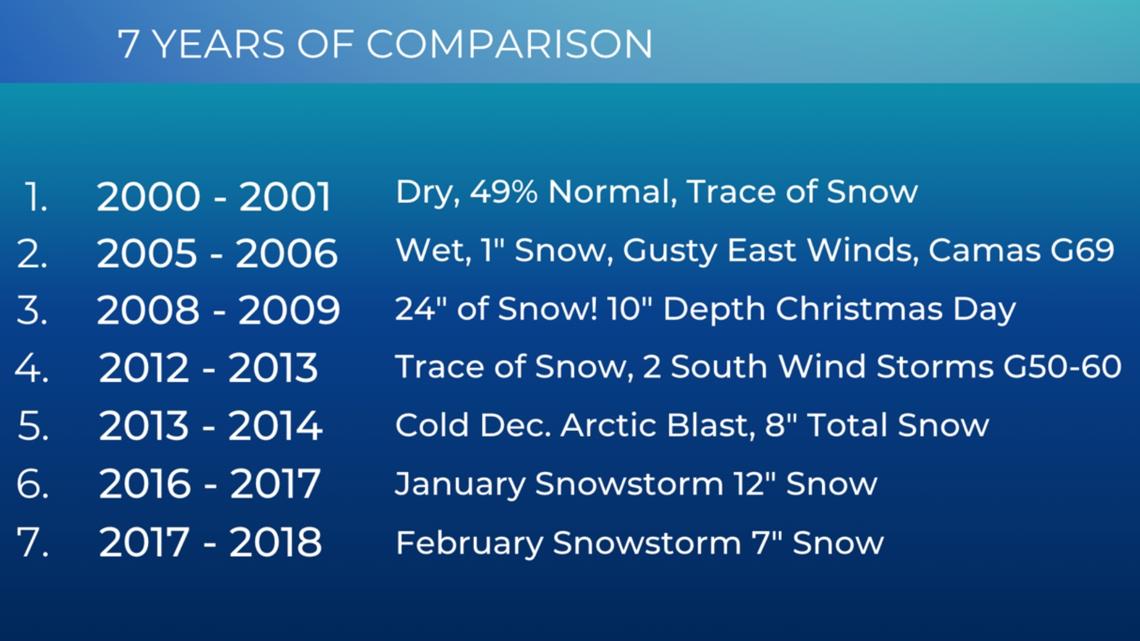
What the past predicts
The seven comparison winter seasons I am basing my conclusions on include a mixed bag of no to little snow seasons to a couple of monster snowstorms including the 10 inches of snow on the ground on Christmas Day in 2008, which stands as a record to this day. The data set also shows the cold Arctic blast of 2013.

Good snowpack in the mountains
One of my high confidence calls is for a good snowpack year over the Cascades, including Mount Hood. Last year got off to a slow start and finished the season at 83% of normal. This year, I see a fast start with Mount Hood bases building as early as Dec. 10 after possible Thanksgiving skiing. My Christmas week resort bases show healthy numbers and could be too low.

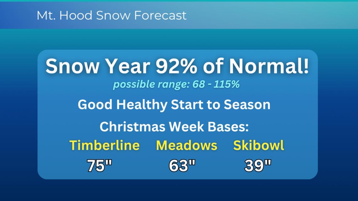
It is well documented that La Niña winters average the largest snow years on Mount Hood and neutral winters come in second, so there are many reasons to be optimistic for a good snow season in the Cascades.


Winter outlook summary
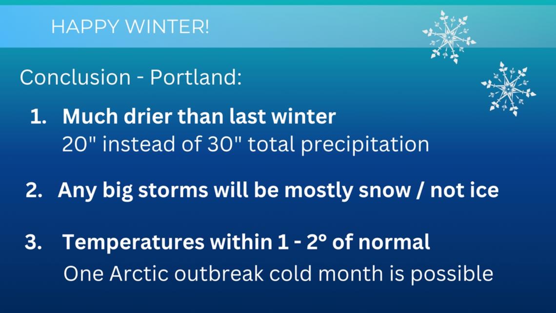
This year's winter outlook does not show as many confident points as my last two years, but the data does support a drier than normal rainy season with temperature averages over the five-month period within two degrees of the climate norm. Although the computed average for a snowstorm chance is 60%, I do expect a favorable chance of snow days.
As stated, if we get a big winter event, I expect valley snow, not ice. Neutral to La Niña winters favor Arctic outbreaks that could produce one cold month with east winds out of the Gorge feeding a snow event as cold Pacific lows push inland.

Portland 2023-2024 winter review
Last winter's outlook was based on an El Niño pattern. My forecast work correctly predicted a slow start to the Mount Hood snow season with little to no snow on the ground to start Christmas week.
I also projected that we would see little snow because any big storms would be mainly ice, meaning sleet and/or freezing rain. The ice storm of January was mostly sleet in Portland and freezing rain in the mid to south valley.
The third projection called for a mild December that would be more than four degrees above normal average. December 2023 went into the record book as the second warmest of all time at the Portland International Airport.