PORTLAND, Ore. — Summer officially starts on Thursday as Portland sees a stretch of dry, sunny and warm weather. Oregon will enter the season drought-free for the first time in a number of years. That's hopeful news when it comes to mitigating the risk of wildfires.
How warm will it get in Portland this summer? Will temperatures climb to 100 degrees? KGW meteorologist Rod Hill answered those questions and shared his projections in his Summer Weather Outlook.
Temperatures
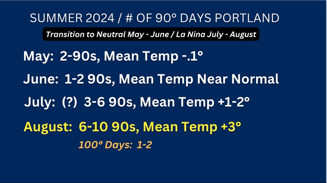
There were two 90-degree days in Portland in May, and the monthly mean temperature average was slightly below normal. To date, both May and June have seen near normal precipitation.
Hill's outlook shows the month of June will likely finish with mean temperatures near normal. Portland could hit 90 degrees on the summer solstice and again on Friday — the only two days in June that could possibly hit 90 degrees, according to Hill.
He projects that July will see temperatures one to two degrees above normal, with three to six days of 90-degree weather.
August has the best chance to see temperatures well above what's considered to be normal, with possible mean temperatures three degrees above normal. Hill projects Portland could see six to nine 90-degree days.

"The lack of hot days and near normal spring rainfall May and June will send Oregon into the summer season with hope of a somewhat quiet fire season," Hill said.
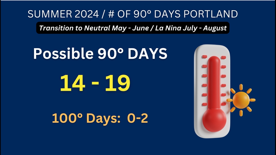
Hill projects there will be 14-19 total 90-degree or above days in Portland through September.
"Assuming Portland holds below 20 total hot days, this will become the coolest summer in terms of 90-degree heat since the summer of 2000 when PDX (Portland) hit 90 or better 15 days," Hill said.
On average, Portland sees a total of 16 90-degree days, dating back to 2000. But many summers have seen 90-degree heat 20 days or more, Hill said.
He also projects that Portland will see zero to two days of 100-degree heat.

"The message is brace for periods of hot weather in July and August, but season totals will show less heat when compared to the past three summers," Hill said.
July and August average less than an inch of total rainfall during the two-month period.
"Summer rain is always precious, making a lack of hot weather super important in terms of dampening wildfire risk," Hill said.
Drought
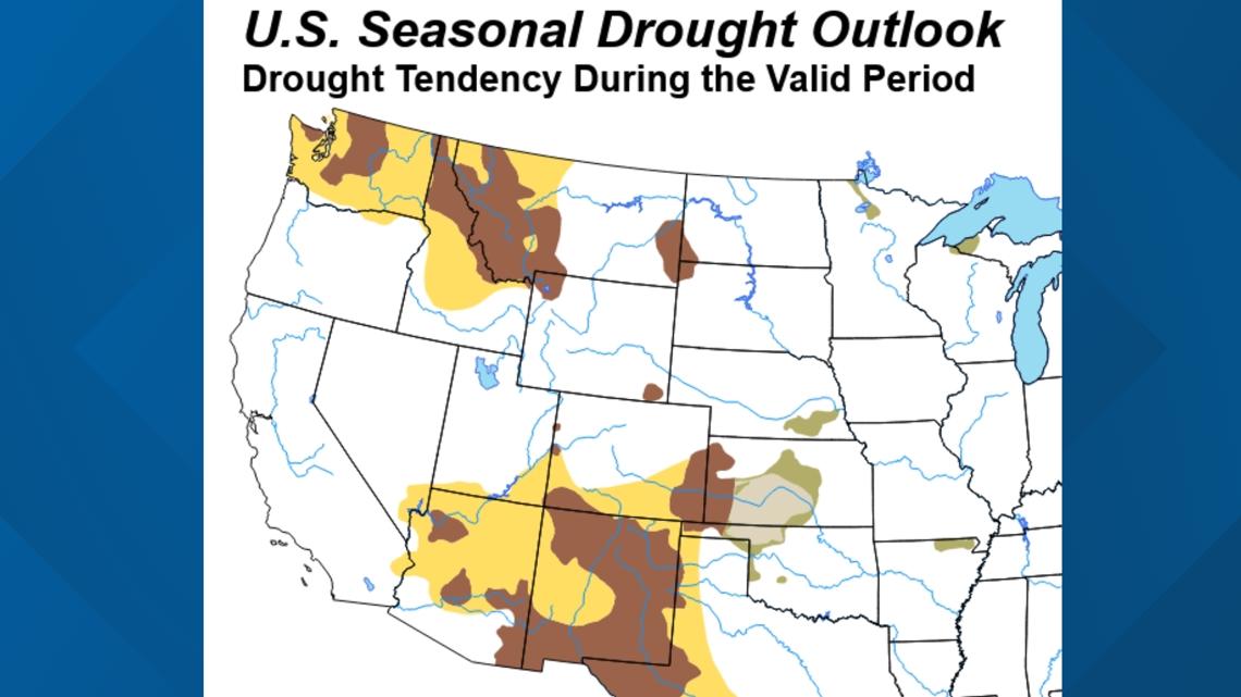
The National Oceanic and Atmospheric Administration (NOAA) released an outlook map showing their U.S. drought status projection through Aug. 31.
Oregon will remain drought-free this summer, except for a small portion of the Columbia Basin, as shown in NOAA's outlook map below. In Washington, drought conditions are expected to increase. The yellow areas of the map indicate areas where drought development is likely. The brown areas mark where drought persists. No color means there is no drought status.
Drought outlooks are not solely based on precipitation, Hill said. An increasingly larger player in that is the evaporation rate.
"The fact there are climates warming leads to a more rapid drying out of the soils and our forest lands. So, the warmer weather also leads to drought even if you're getting what's considered to be normal precipitation," Hill said.