PORTLAND, Ore. — Portland closed out the year with a string of warm days that cemented the final month of 2023 as one of the warmest on record in the region, fulfilling predictions that the ongoing El Niño weather pattern over the Pacific Ocean could heat things up for the Pacific Northwest.
But that doesn't necessarily mean that Portlanders should expect more of the same for the rest of the winter season, according to KGW meteorologist Rod Hill. Colder temperatures are on the way later this week, and January overall is likely to be much colder, bringing a return of more typical winter weather for the region, especially in the mountains.
Top of the charts
December was a record-breaker for warm winter weather in Portland, with an average daily high of 51.4 degrees recorded at Portland International Airport, tying with December 1950 as the warmest December on record, according to Hill. The records date back to about 1940.
Dec. 4 also broke the all-time individual day heat record for December in Portland with a high of 67 degrees. The average low was 40.9 degrees, making it Portland's second-warmest December ever, and it was also the second-warmest by temperature over the entire month with a mean temperature of 46.1 degrees, which is 4.5 degrees above normal.

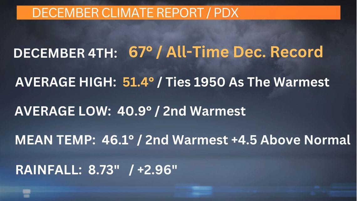
The month saw 8.73 inches of total rainfall — nearly three inches above normal — but with temperatures so high, relatively little of that precipitation translated into snowfall even up in the mountains. This winter's snowpack has been more than 60% short of normal levels so far, to the disappointment of skiers and snowboarders hoping to hit the slopes on Mount Hood.
Cascades getting colder
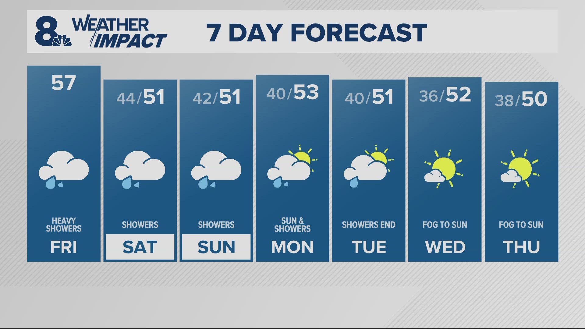
Conditions will swing back closer to average for the region in January, Hill said, starting with a cold front that's expected to arrive Saturday morning and bring an abrupt end to the mild weather.
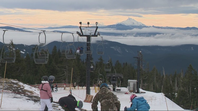
There's already good news up at Timberline Lodge, where temperatures remained below freezing Tuesday night after the resort picked up more than two inches of snow during the day. That's a big deal, Hill said, because it's a major part of why the snowpack is so low at the moment — warm December nights prevented new snow from sticking around.
A few more inches of snow are on the way for Mount Hood Wednesday night and Thursday morning, he added, but the big change will arrive on Saturday when the incoming cold front brings winter storm conditions to the Cascades, dropping snow levels down to about 2,000 feet and likely depositing more than a foot of snow at Mount Hood on Saturday alone.

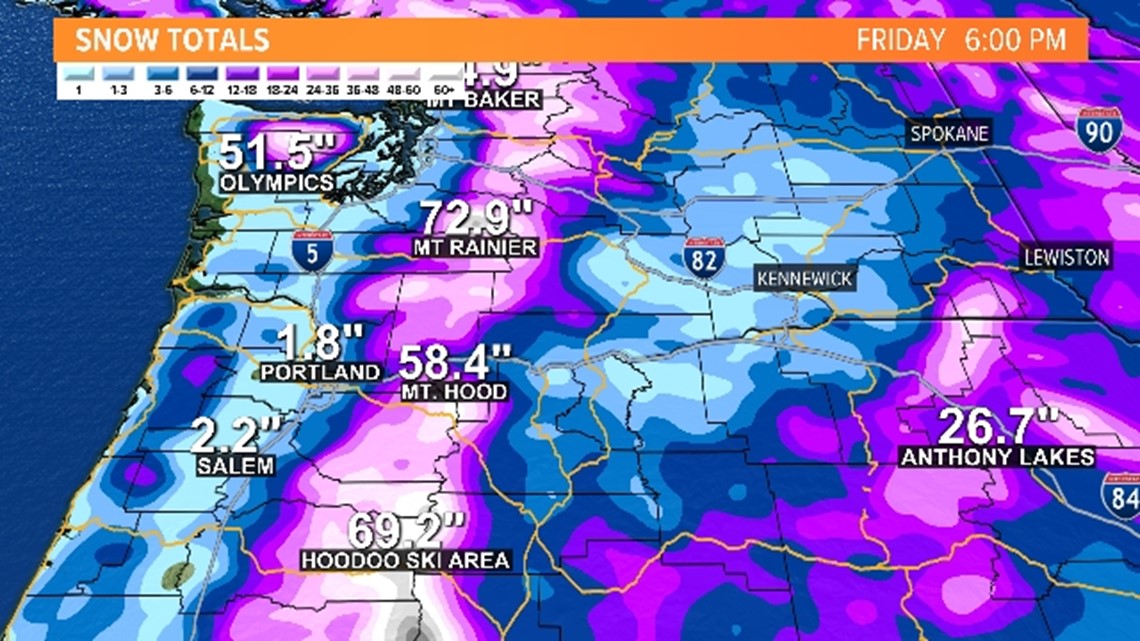
That trend will continue with more winter weather systems arriving in the first half of next week, he said. Current forecast models show that Mount Hood is expected to pick up a total of more than 58 inches of snow over the next nine days, and the Hoodoo ski area could land more than 69 inches.
"If this is true, we will bounce at least up into 40, 45% of normal snowpack, and maybe we'll get back up to at least 50%," Hill said.
So far, that's all in line with Hill's earlier Winter Outlook report, and he noted that the report also predicted more snow in February, March and April to finish the season with about 70% of the usual snowpack.
What about Portland?
Snow is definitely on the way for the Cascades, but the forecast for Portland and the Willamette Valley is still much more open-ended, Hill said.
The shift in weather is being driven by cold arctic air finally starting to move in and gather over Canada this week after almost no buildup in December, he explained. That air mass will grow and push southward, spilling over into Washington and Idaho, although current models show the Arctic air stopping just short of the Portland area.

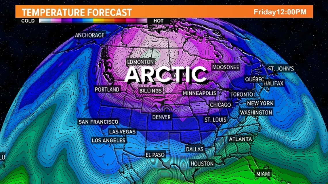
For Portland to get snow, that forecast would have to change and see the cold air move a bit further south, which would result in cold east winds getting funneled west through the Columbia River Gorge. If those winds run into weather systems coming in from the Pacific Ocean, that's when Portland could start to see a chance for more wintry weather.
"For now, I'm not seeing that," Hill said. "But I am seeing the cold air filtrate down across much of the country, and we're going to get enough of it to drop Cascade snow levels pretty consistently to 4,000 feet and lower over the next couple of weeks."
So while there is a possibility of snow in the valley next week, as of Wednesday it looks like Portland is more likely to get mostly rain, he said, with especially heavy rain on Saturday and more heavy rain and winds on Tuesday.