

GOVERNMENT CAMP, Ore. — The Cascade Mountains are in for a round of fresh snow this week. It's expected to be the heaviest mountain snowfall of the season so far.
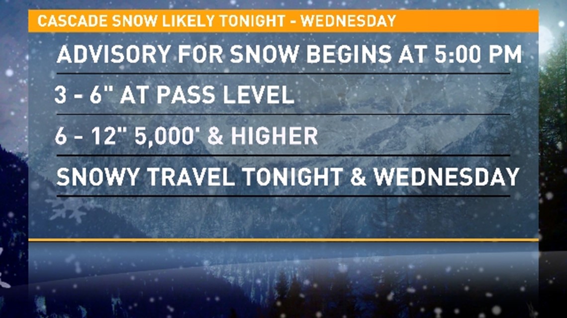
The National Weather Service has issued a Winter Weather Advisory, which will be in effect from 5 p.m. on Tuesday until 5 p.m. on Wednesday. As of Wednesday morning, 10 inches of snow had fallen at Timberline Lodge and roads in the passes reported four to six inches of snow on the ground, KGW meteorologist Rod Hill said.
Anyone planning to travel through the Cascade passes should prepare for winter driving conditions, Hill warned.
"Especially if you’re traveling over the high country — going back and forth between the valley, the coast or central Oregon — be prepared for sticking snow and icy roadways at times tonight and tomorrow morning, and tomorrow during the day," Hill said.
More than a foot of snow is expected to fall in the ski areas near Mount Hood through Wednesday evening. Elevations at 5,000 feet and higher could see six to 12 inches of snow.
Another storm set to arrive on Thursday will keep the snowfall coming, Hill said. The Willamette Valley will only see scattered rain showers.

Willamette Valley in for frosty mornings this weekend
Cold and frosty mornings are on the way for some parts of the Willamette Valley. Low temperatures are expected to be in the low 30s and Friday, Hill said.
“Depending on what the wind is, we’ll see how low temperatures go. But if you live in a spot where you don’t get east winds much, you absolutely should expect a hard freeze maybe Saturday morning but certainly Sunday and Monday," he said. "In fact, there could be temperatures (going) as low as 2, 28 degrees."
WATCH: KGW weather playlist