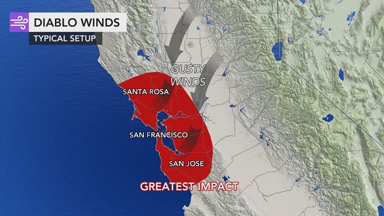
The fires that have wreaked havoc in California during recent weeks have been fueled by strong winds, which have made it challenging for firefighters battling the blazes, and they have forced residents to flee their homes in one of the largest evacuations in state history.
Just as Southern California has its notorious Santa Ana winds that fan wildfire flames, Northern California's winds are known as Diablo winds.
Diablo winds appear around the San Francisco Bay region and are produced by the same mechanism that produces a Santa Ana wind. These winds are magnified by terrain effects similar to Santa Ana winds.
 Image via the National Weather Service Storm Prediction Center.
"The term Diablo winds refers to winds that flow from east to west up and over the Diablo Range over the East Bay region of the San Francisco Bay area," AccuWeather Senior Meteorologist Dan Kottlowski said.
These winds that fan catastrophic Northern California fires are most common during the winter, spring and fall but can occur during the late summer as well.
"This wind flow is created the same way Santa Ana winds form. Surface pressure in the Great Basin builds much higher than the surface pressure in the San Francisco Bay area. This pressure difference causes the strong easterly downsloping winds into the Sacramento Valley and up and over the Diablo range," Kottlowski said.

Diablo, a Spanish word which translates to devil in English, is also the name of a mountain in Contra Costa County, which is where these winds originate.
"Mount Diablo is an actual mountain peak with an elevation of 3,848 feet. This mountain is notorious for strong winds. Typically, when the winds are flowing from east to west out of the Sierra Nevada Mountains to the east, they sink as they move into the lower elevation areas of the Sacramento Valley then move up and over the Diablo range," Kottlowski said.
The winds, which are capable of reaching hurricane force, almost always bring a great surge in temperature and plenty of dry air.
"The winds increase as the air is forced up over the Diablo Range and can reach winds gusts over 80 mph," Kottlowski said.
While this wind pattern occurs in both the spring and fall, it is most dangerous in the fall, when vegetation is at its driest.
"During these Diablo wind events, there can be wind damage leading to power outages. When the vegetation is very dry, this leads to an increased fire danger," Kottlowski said.


