PORTLAND -- Experts say it's not a matter of if but when a major earthquake strikes off Oregon s coast sending a catastrophic tsunami onto our shores.
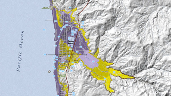
Now, for the first time, scientists have mapped the entire Oregon coast to show just how far inland a tsunami would come.
Scientists spent four years creating the 131 maps, which show tsunami inundation zones in the event of a distant tsunami and a local tsunami, such as one originating from the Cascadia Subduction zone offshore.
The maps also show evacuation routes people can take to escape it.
View:Free Evacuation Maps
We have 10 assembly areas where people are supposed to go and those assembly areas have in some cases been moved slightly to accommodate the new inundation zone for a Cascadia event, said Cannon Beach City Manager Rich Mays.
Coastal business owners hope the maps will give visitors a little peace of mind. Geologists acknowledge we are due for a mega magnitude-9 earthquake along the Cascadia Subduction zone.
They seem to happen about every 300 years was and the last one was 313 years ago so we re definitely in that window of time, explained Peter Ovington a Geologic Hazards Outreach Specialist with the Oregon Department of Geology.