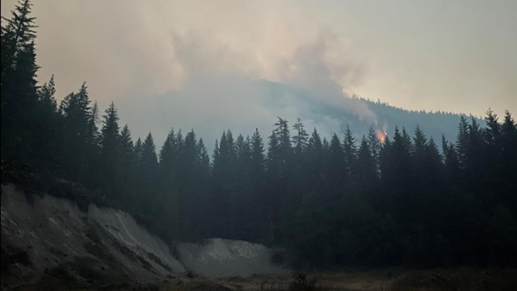
COWLITZ COUNTY, Wash. — The Kalama Fire grew five acres since Sunday morning, bringing it to 112 acres in size as of Tuesday afternoon, according to the U.S. Forest Service.
Due to moderating fire weather and additional resources, the Cowlitz County Sheriff's Office has issued updated evacuation orders.
Level 3 (Go Now) evacuation orders are no longer in place.
Level 2 (Get Set) evacuations remain in place for the following locations:
- North to South: From the Headwaters of the South Fork of the Toutle River, south to Forest Road 7550
- East to West: From the Skamania County/Cowlitz County border west 5 miles into Cowlitz County
Level 1 (Get Ready) evacuations remain in place for the following locations:
- North to South: South from Forest Road 7550 to south of Merrill Lake
- East to West: Skamania County/Cowlitz County border west 5 miles into Cowlitz County
Level 3 (Go Now) evacuations were ordered by the Cowlitz County Sheriff's Office for the Kalama Fire on Friday, as the fire began growing in the Gifford Pinchot National Forest southwest of Mount St. Helens.
The fire is located on a cliff face surrounded by steep ground which makes it difficult for firefighters to engage, according to a tweet from the official Mount St. Helens park account. Crews used helicopters and hose lines to try to slow the spread.
Smoke in the air to the south of Mount St. Helens on Saturday afternoon and evening was coming from Oregon rather than the Kalama Fire, according to a tweet from the official Gifford Pinchot National Forest account, and the extra smoke can actually be beneficial for fire suppression efforts by stabilizing the air and cooling things down.
The fire, which grew from 4 to 112 acres from Thursday to Tuesday, is not affecting the city of Kalama or residents along Kalama River Road, the U.S. Forest Service reported.
Several fires are burning around the state. In Central Oregon, about 15 miles east of Oakridge, the Cedar Creek Fire has burned roughly 134 square miles, an area more than two times the size of the city of Eugene, and prompted Level 3 evacuation orders for areas around the town of Oakridge.
With hot temperatures, low humidity and strong east winds this weekend creating conditions for extreme fire danger, multiple utility companies around Oregon started public safety power shutoffs Friday morning for people living in high-risk areas. Shutoffs are scheduled through at least Saturday.


