
PORTLAND, Ore. —
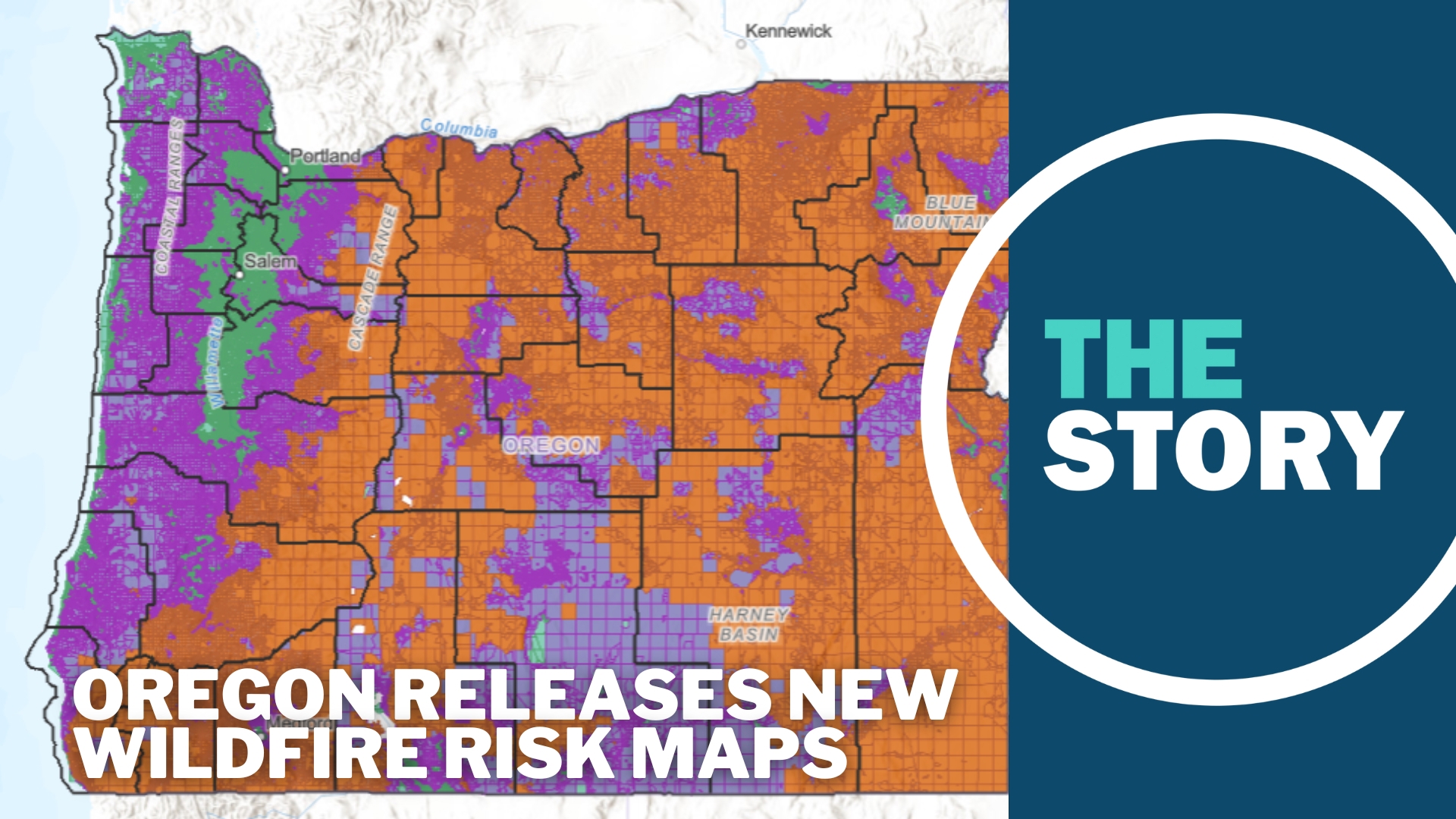
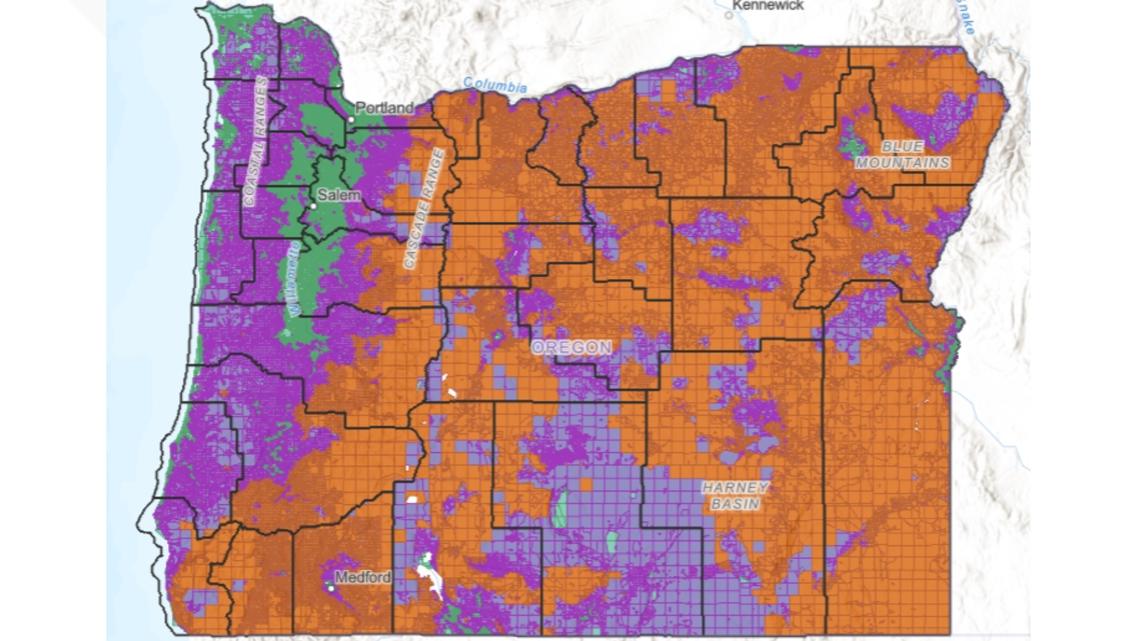
Oregon has released a new version of a set of maps that show wildfire risk for every property in the state.
The maps, which are still in draft form, will be used to determine which properties meet the criteria for future regulations that could create mandates for defensible space around homes and stricter building codes in fire-prone areas.
Andy McEvoy, a research assistant at Oregon State University’s College of Forestry, said the maps will help the state respond to wildfires, which have grown in size, frequency and intensity due to human-caused climate change.
“We are facing a longer fire season. We are facing more fires within that period of time, fires in new places, we are facing unprecedented fuel conditions,” McEvoy said. “The context in which we're living and fighting fire is all changing, and we have to adapt to that as a state.”
This is the second time the state created these maps, which are mandated under a law passed in 2021. The first versions were met with fierce backlash from the public.
Many were concerned about how the maps could impact insurance rates. Others said the maps seemed arbitrary, with some people showing different risk classifications than their neighbors.
“You have properties that have manicured landscaping, flat lands that is all green and is listed as extreme,” former State Rep. Lily Morgan, of Grants Pass, told KGW in 2022. “Where across the street you have vegetation that is not irrigated and clearly dry brush and it's not listed as extreme.”
The pushback on the original maps was so extreme that the state rescinded them within a few weeks.
McEvoy said it was disappointing to have to pull them back, but the public’s concerns were understandable.
“It was frustrating,” he said, noting that the maps were released without much public outreach to prepare residents for what the maps were intended for or how they would be used.
“When we went out into the public to try to speak about how we developed the map and how the map will be used, we didn't have all the answers at that time,” McEvoy said.
Since then, legislators passed Senate Bill 82, which prohibits insurance companies from basing rates on the maps.
The state has also tried to simplify the maps. The first version had five tiers, ranging from no risk to extreme. The new version has three: low, moderate and high.
McEvoy and the other folks who developed the current draft also listened to feedback and made some changes to how pastureland and irrigated croplands are classified. Those changes resulted in lower risk categories for nearly 2 million acres and some 20,000 tax lots, McEvoy said.

State officials also embarked on a bit of a listening tour ahead of the maps’ release, hosting open houses in Medford, Klamath Falls, Grants Pass, Redmond, The Dalles and La Grande.
“They were fantastic,” McEvoy said. “They were really, very much in contrast to 2022, these were really productive.”
The maps not only show risk levels for each piece of property in the state, but they also show which lots fall into the wildland-urban interface, where development bumps up against fire-prone natural areas.
Properties that fall into the highest risk category, as well as the wildland-urban interface, will likely be subject to regulations around defensible space and stricter building codes.
Those regulations are still a work in progress and the maps themselves are still just drafts.
The public has been invited to weigh in on the drafts until Aug. 18, at which point state agencies will work to incorporate feedback from the public and county commissioners before the maps can be finalized by the Board of Forestry.
At that point, notices will go out to property owners who live in areas that could be subject to regulation, and they’ll be given a chance to appeal their classification.
McEvoy said he understands that not everyone will be happy about the maps, or the prospect of new regulations, but he said that previous catastrophic wildfire seasons have proven the need for a new approach.
“I certainly expect plenty of folks to have some some criticisms of it,” he said. “But I think by and large the public is is ready to embrace the need for Community wildfire risk reduction in Oregon and really sort of sees the motivation here, which is reducing disasters in the future.”