
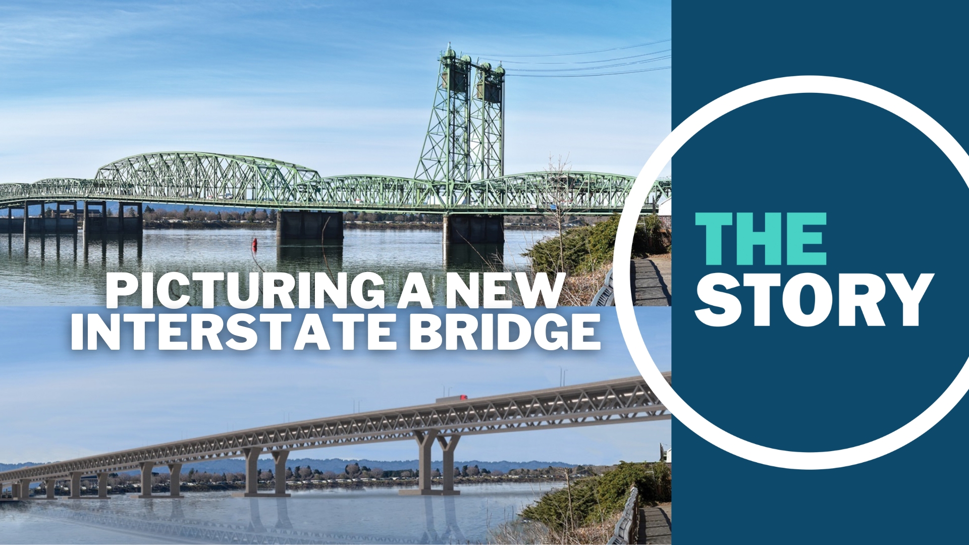
PORTLAND, Ore. — The Interstate Bridge Replacement Program hit a key milestone last week with the release of the megaproject's Draft Supplemental Environmental Impact Statement, and the lengthy report included about a dozen new visualizations that insert models of the bridge into real-world photos for the first time, setting up simulated before-and-after shots and providing a clearer sense of what the new crossing would look like when built.
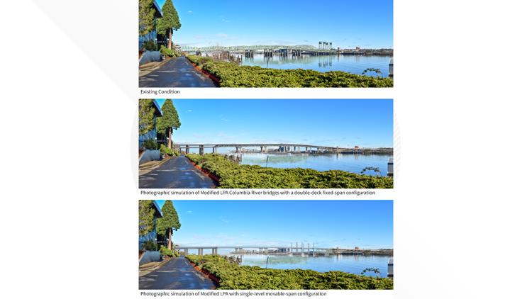
The current twin bridges are hard to miss with their distinctive green shade and 200-foot lift span towers, but their eventual replacement could rise even higher along much of its length. Several of the new renderings show multiple versions of the replacement bridge, because the project team is still working to get the U.S. Coast Guard to sign off on a "fixed crossing" design instead of a drawbridge.
No matter which direction the project ultimately takes, the report stresses repeatedly that the images for both configurations are very early mockups and do not represent the final bridge design, so they should be viewed with that in mind.
Check out the new images in the gallery below:
PHOTOS: Simulated images of the proposed Interstate Bridge replacement


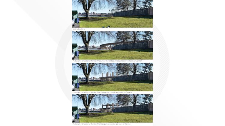

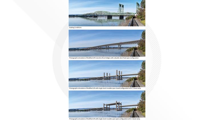

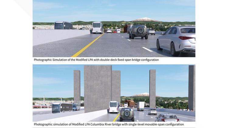


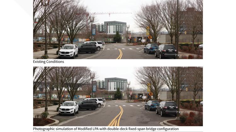

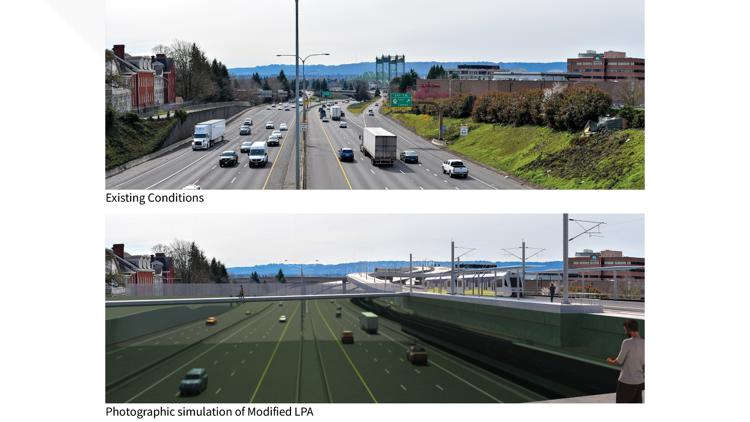

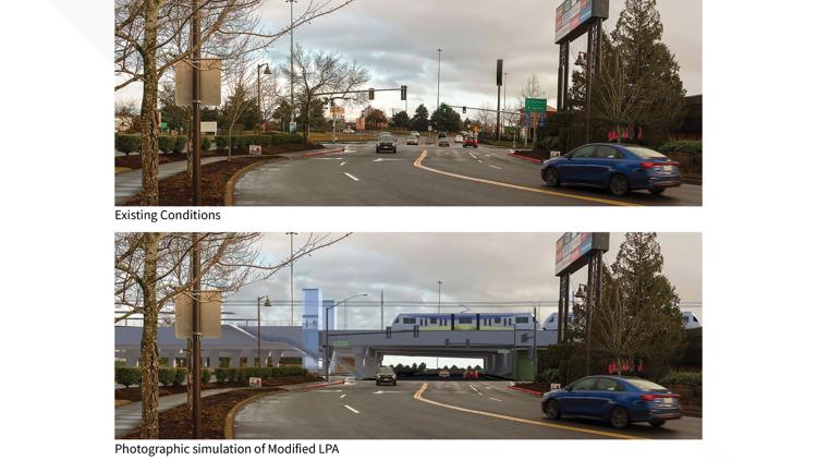

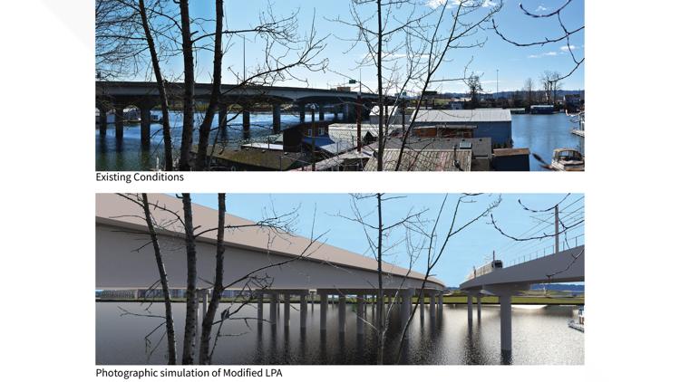
The images show multiple components of the project close-up, including the new light rail station at Evergreen Boulevard and the adjacent "community connector" cover over I-5, the light rail line on Hayden Island, the replacement for the North Portland Harbor Bridge and shots from downtown Vancouver to show how the new bridge would fit into the skyline.
There are also renderings that show the full length of the bridge as seen from vantage points to either side on Hayden Island as well as one to the east of the bridge on the Vancouver side.
Notably absent are any images showing the bridge close-up from Vancouver on the west side, especially from the Vancouver Waterfront area where the bridge, the SR-14 interchange, the elevated waterfront light rail station and the bike and pedestrian path ramp will all be prominent when looking to the east.
The Draft SEIS Visual Quality Technical Report notes that "viewers in close proximity, such as the waterfront development and the upper levels of high-rise buildings in Vancouver, would likely experience moderate to high visual impacts," so the report's lack of simulated images of those particular impacts is a curiosity, although the report does discuss mitigation measures such as lighting, landscaping and artwork, and a possible public space below the bridge.