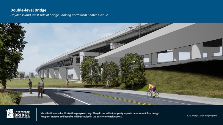
VANCOUVER, Wash. — The Interstate Bridge Replacement Program released new visualizations of the proposed I-5 crossing this week, providing a better sense of how the proposed $6 billion replacement bridge would look and feel, particularly for people standing on it or nearby.
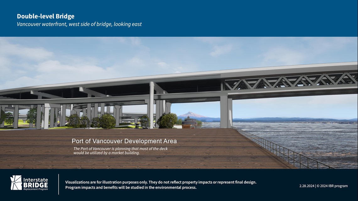
The project team has published renders before, but they focused on the center of the river to compare different bridge configuration options. The new images released this week get up close, and they show the new bridge would loom large over Hayden Island and the Vancouver waterfront.
"These new images show each of the bridge configurations (single-level, double-level, and moveable span) being analyzed in the Draft Supplemental Environmental Impact Statement from different viewpoints close to the proposed structure or while traveling on the shared use paths in these areas," IBR program administrator Greg Johnson said in a statement. "The images include one example bridge type for each of the bridge configurations: extradosed bridge for single-level, truss bridge for double-level, and girder bridge for a moveable span. They do not represent a complete range of bridge types being considered. No decision has been made on the bridge type or configuration at this time."

The current bridge includes a drawbridge section over the main Columbia River shipping channel, so it sits fairly low above the water on the north side of the river — only about 32 feet up when the lift span is closed, according to the Oregon Department of Transportation. The project team wants to get rid of the drawbridge, which means the replacement needs to be significantly higher.
The project team is aiming for 116 feet, but even that might not be enough. The U.S. Coast Guard will need to sign off on the plan before construction can begin, and the agency has so far appeared skeptical — which is why the project still includes a drawbridge as one of the design options, in case the team is unable to convince the Coast Guard.
But judging by the images released this week, even the drawbridge option would still be much higher than what’s there today.

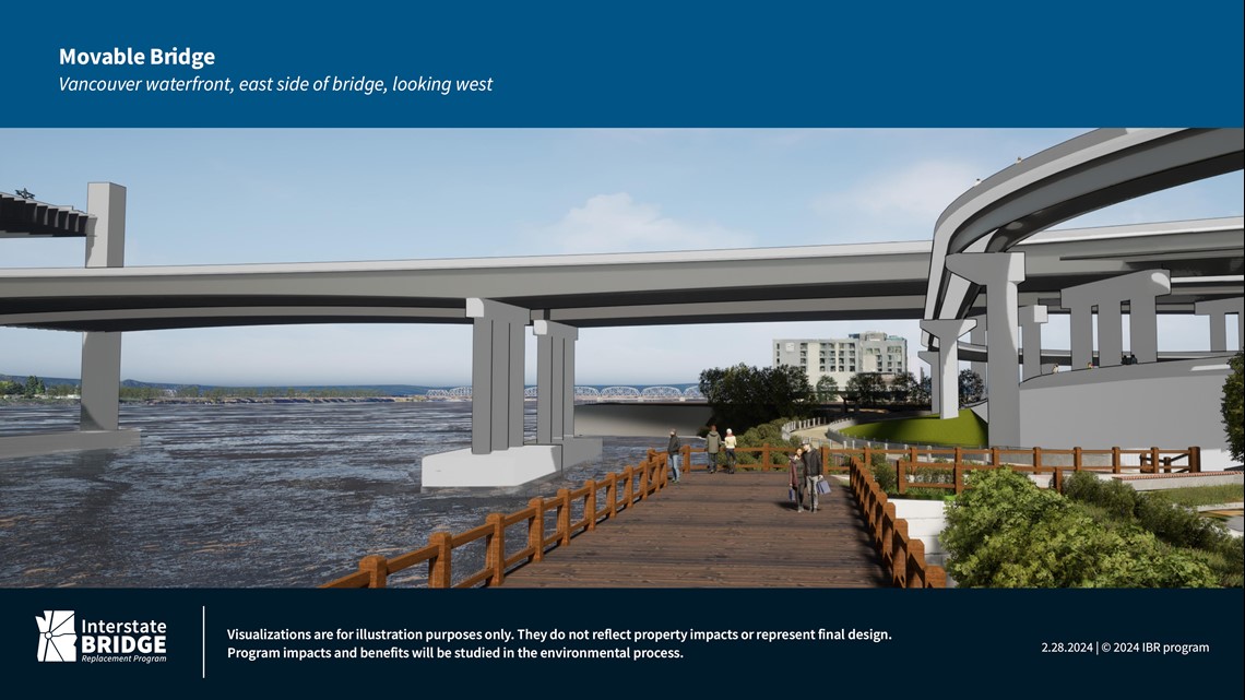
There are a dozen new images that show a few different bridge design options from four vantage points: two from the Vancouver waterfront, one from the ground on Hayden Island, and one from the bike and pedestrian path on the bridge itself. Some of the Vancouver waterfront images show part of the long spiral ramp that bikers and pedestrians would need to use to get up to the bridge.
Overhead wiring for light rail is also visible on the bridge in most of the images. The project team would include an extension of the MAX Yellow Line across the river, with new stations at Hayden Island, the Vancouver waterfront and downtown Vancouver.

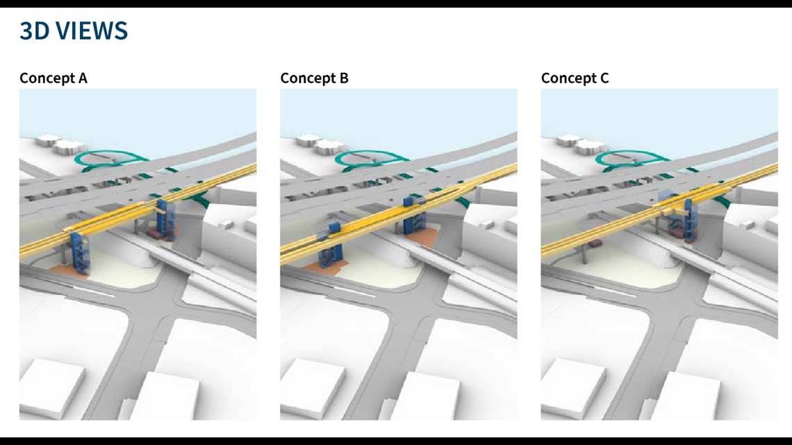
The waterfront station would be right by the end of the bridge, which means it would also have to be very high up. It's not visible in the images released this week, but the project team published concept images in January that gave some sense of the height challenges involved.
The final decision on the bridge configuration will come after the project finishes its federal environmental review process and puts out a Draft Supplemental Environmental Impact Statement for public review, which is expected to happen at some point in the next few months.


